
Haute Fagnes160 RO
A cycling route starting in Klimmen, Limburg, The Netherlands.
Overview
About this route
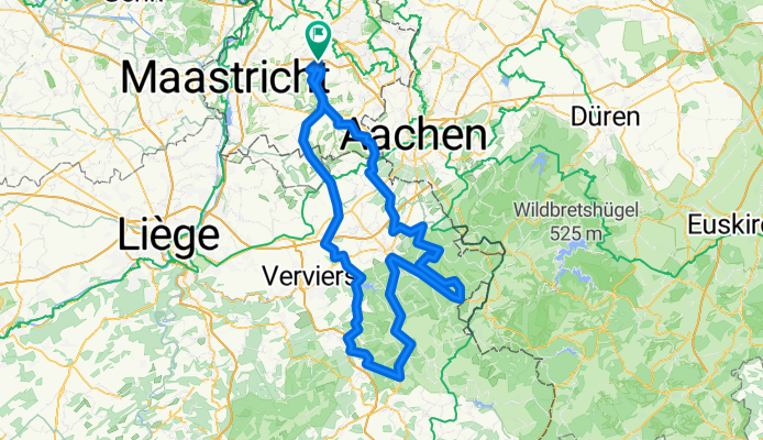
Vanuit Klimmen naar de Belgische Hautes Fagnes (Hoge Venen). Vanuit Raeren door de Hoge Venen alsmaar stijgend 'vals' plat en dan via Eupen naar de Baraque Michel en Signal de Botrange, het hoogste punt van België!
- 10 h 43 min
- Duration
- 160.8 km
- Distance
- 2,211 m
- Ascent
- 2,211 m
- Descent
- 15 km/h
- Avg. speed
- 678 m
- Max. altitude

Route quality
Waytypes & surfaces along the route
Waytypes
Road
53.1 km
(33 %)
Quiet road
28.9 km
(18 %)
Surfaces
Paved
117.4 km
(73 %)
Unpaved
12.9 km
(8 %)
Asphalt
115.8 km
(72 %)
Gravel
6.4 km
(4 %)
Continue with Bikemap
Use, edit, or download this cycling route
You would like to ride Haute Fagnes160 RO or customize it for your own trip? Here is what you can do with this Bikemap route:
Free features
- Save this route as favorite or in collections
- Copy & plan your own version of this route
- Split it into stages to create a multi-day tour
- Sync your route with Garmin or Wahoo
Premium features
Free trial for 3 days, or one-time payment. More about Bikemap Premium.
- Navigate this route on iOS & Android
- Export a GPX / KML file of this route
- Create your custom printout (try it for free)
- Download this route for offline navigation
Discover more Premium features.
Get Bikemap PremiumFrom our community
Other popular routes starting in Klimmen
 Hulsberg 1
- Distance
- 50.4 km
- Ascent
- 248 m
- Descent
- 248 m
- Location
- Klimmen, Limburg, The Netherlands
 Pletskeskooktoer!
- Distance
- 63.8 km
- Ascent
- 364 m
- Descent
- 365 m
- Location
- Klimmen, Limburg, The Netherlands
 Hell2024_Signaleurs
- Distance
- 150.8 km
- Ascent
- 1,752 m
- Descent
- 1,752 m
- Location
- Klimmen, Limburg, The Netherlands
 PijnVen
- Distance
- 150.6 km
- Ascent
- 845 m
- Descent
- 846 m
- Location
- Klimmen, Limburg, The Netherlands
 Z29 LouisRonde3
- Distance
- 89.3 km
- Ascent
- 871 m
- Descent
- 873 m
- Location
- Klimmen, Limburg, The Netherlands
 Rondje Hulsberg-Kotum(B)-Hulsberg.
- Distance
- 47.3 km
- Ascent
- 123 m
- Descent
- 126 m
- Location
- Klimmen, Limburg, The Netherlands
 WimsMooiste, LO
- Distance
- 96.7 km
- Ascent
- 781 m
- Descent
- 781 m
- Location
- Klimmen, Limburg, The Netherlands
 Klimmen-Bütgenbach1, 2024
- Distance
- 82.1 km
- Ascent
- 1,310 m
- Descent
- 883 m
- Location
- Klimmen, Limburg, The Netherlands
Open it in the app