Do Wilczej Woli nad zalew Maziarnia
A cycling route starting in Pysznica, Subcarpathian Voivodeship, Poland.
Overview
About this route
- -:--
- Duration
- 81.7 km
- Distance
- 117 m
- Ascent
- 121 m
- Descent
- ---
- Avg. speed
- ---
- Max. altitude
Route quality
Waytypes & surfaces along the route
Waytypes
Road
44.1 km
(54 %)
Cycleway
13.3 km
(16 %)
Surfaces
Paved
64.9 km
(79 %)
Unpaved
0.1 km
(<1 %)
Asphalt
61.8 km
(76 %)
Paving stones
3.1 km
(4 %)
Continue with Bikemap
Use, edit, or download this cycling route
You would like to ride Do Wilczej Woli nad zalew Maziarnia or customize it for your own trip? Here is what you can do with this Bikemap route:
Free features
- Save this route as favorite or in collections
- Copy & plan your own version of this route
- Split it into stages to create a multi-day tour
- Sync your route with Garmin or Wahoo
Premium features
Free trial for 3 days, or one-time payment. More about Bikemap Premium.
- Navigate this route on iOS & Android
- Export a GPX / KML file of this route
- Create your custom printout (try it for free)
- Download this route for offline navigation
Discover more Premium features.
Get Bikemap PremiumFrom our community
Other popular routes starting in Pysznica
- Mini trip do Zwierzyńca - dzień I
- Distance
- 79.2 km
- Ascent
- 251 m
- Descent
- 182 m
- Location
- Pysznica, Subcarpathian Voivodeship, Poland
- Po drożach i bezdrożach Lasów Janowskich (+ Bomba)
- Distance
- 88.2 km
- Ascent
- 114 m
- Descent
- 115 m
- Location
- Pysznica, Subcarpathian Voivodeship, Poland
- 22.05
- Distance
- 78.3 km
- Ascent
- 55 m
- Descent
- 56 m
- Location
- Pysznica, Subcarpathian Voivodeship, Poland
- Trainspotting 2
- Distance
- 189.7 km
- Ascent
- 383 m
- Descent
- 385 m
- Location
- Pysznica, Subcarpathian Voivodeship, Poland
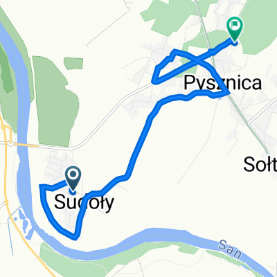
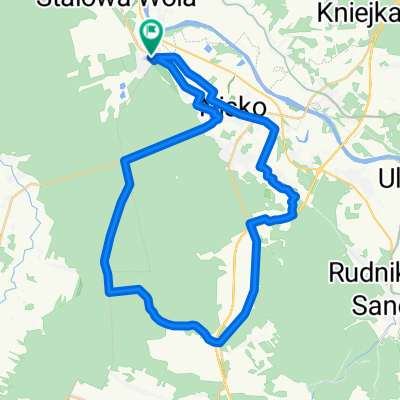
- Pysznica - Radomyśl - Kępie Zaleszańskie - Stalowa Wola - Pysznica
- Distance
- 53.4 km
- Ascent
- 26 m
- Descent
- 27 m
- Location
- Pysznica, Subcarpathian Voivodeship, Poland
- Wycieczka 25 LUTY
- Distance
- 62.3 km
- Ascent
- 273 m
- Descent
- 272 m
- Location
- Pysznica, Subcarpathian Voivodeship, Poland
- Lasy |Janowskie - odcinek 1214
- Distance
- 115.3 km
- Ascent
- 149 m
- Descent
- 148 m
- Location
- Pysznica, Subcarpathian Voivodeship, Poland
- noworocznie po okolicy
- Distance
- 40.2 km
- Ascent
- 89 m
- Descent
- 88 m
- Location
- Pysznica, Subcarpathian Voivodeship, Poland
Open it in the app