

massif east 1
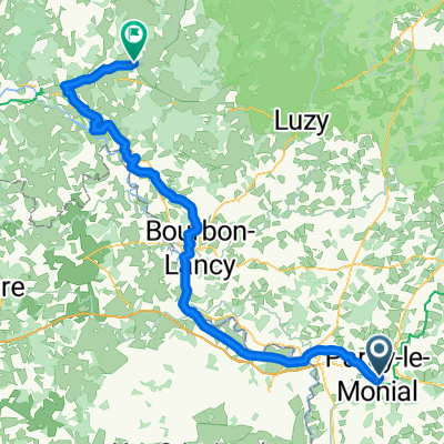
A cycling route starting in Paray-le-Monial, Bourgogne-Franche-Comté, France.
Overview
About this route
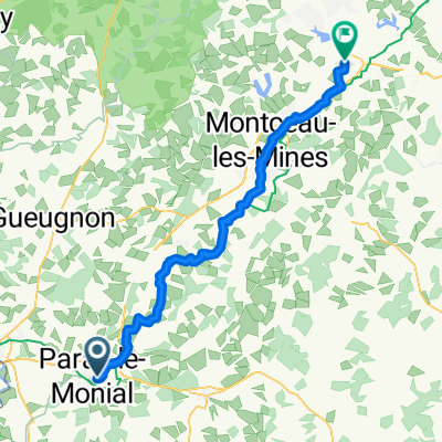
possible route that only goes to 800 m but a few ups and downs
- -:--
- Duration
- 473.1 km
- Distance
- 2,609 m
- Ascent
- 2,698 m
- Descent
- ---
- Avg. speed
- ---
- Max. altitude

Route quality
Waytypes & surfaces along the route
Waytypes
Road
203.4 km
(43 %)
Quiet road
113.5 km
(24 %)
Surfaces
Paved
165.6 km
(35 %)
Unpaved
9.5 km
(2 %)
Asphalt
160.8 km
(34 %)
Gravel
9.5 km
(2 %)
Continue with Bikemap
Use, edit, or download this cycling route
You would like to ride massif east 1 or customize it for your own trip? Here is what you can do with this Bikemap route:
Free features
- Save this route as favorite or in collections
- Copy & plan your own version of this route
- Split it into stages to create a multi-day tour
- Sync your route with Garmin or Wahoo
Premium features
Free trial for 3 days, or one-time payment. More about Bikemap Premium.
- Navigate this route on iOS & Android
- Export a GPX / KML file of this route
- Create your custom printout (try it for free)
- Download this route for offline navigation
Discover more Premium features.
Get Bikemap PremiumFrom our community
Other popular routes starting in Paray-le-Monial
 L3+4 nord: Paray-le-Monial - Macon; 170,1km 250hm
- Distance
- 171.2 km
- Ascent
- 451 m
- Descent
- 507 m
- Location
- Paray-le-Monial, Bourgogne-Franche-Comté, France
 massif east 1
- Distance
- 473.1 km
- Ascent
- 2,609 m
- Descent
- 2,698 m
- Location
- Paray-le-Monial, Bourgogne-Franche-Comté, France
 Etape 6 Paray le Monial - Cercy-La-Tour
- Distance
- 98.3 km
- Ascent
- 172 m
- Descent
- 199 m
- Location
- Paray-le-Monial, Bourgogne-Franche-Comté, France
 From Paray-le-Monial to Montchanin
- Distance
- 54.5 km
- Ascent
- 479 m
- Descent
- 394 m
- Location
- Paray-le-Monial, Bourgogne-Franche-Comté, France
 6a tappa→Paray Le Monial---Cournon D'Auvergne
- Distance
- 138.2 km
- Ascent
- 625 m
- Descent
- 519 m
- Location
- Paray-le-Monial, Bourgogne-Franche-Comté, France
 Paray-le-Monial : circuit n°11 - Vues sur la vallée de l'Arconce, Nochize
- Distance
- 31.5 km
- Ascent
- 195 m
- Descent
- 195 m
- Location
- Paray-le-Monial, Bourgogne-Franche-Comté, France
 Paray-le-Monial - Lucenay-lès-Aix
- Distance
- 67.3 km
- Ascent
- 110 m
- Descent
- 162 m
- Location
- Paray-le-Monial, Bourgogne-Franche-Comté, France
 Tour de Bourgogne 2
- Distance
- 663 km
- Ascent
- 2,930 m
- Descent
- 2,929 m
- Location
- Paray-le-Monial, Bourgogne-Franche-Comté, France
Open it in the app