

70 km Schloss Burg und Müngstenerbrücke.
A cycling route starting in Mülheim, North Rhine-Westphalia, Germany.
Overview
About this route
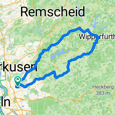
Planned day tour in spring/summer over a lot of asphalt and well-developed forest paths to Burg Castle and then to the Müngsten Bridge. The return is via Witzhelden,
- -:--
- Duration
- 69.7 km
- Distance
- 676 m
- Ascent
- 682 m
- Descent
- ---
- Avg. speed
- ---
- Max. altitude

Route quality
Waytypes & surfaces along the route
Waytypes
Quiet road
22.3 km
(32 %)
Track
20.9 km
(30 %)
Surfaces
Paved
34.8 km
(50 %)
Unpaved
21.6 km
(31 %)
Asphalt
32.8 km
(47 %)
Gravel
10.5 km
(15 %)
Continue with Bikemap
Use, edit, or download this cycling route
You would like to ride 70 km Schloss Burg und Müngstenerbrücke. or customize it for your own trip? Here is what you can do with this Bikemap route:
Free features
- Save this route as favorite or in collections
- Copy & plan your own version of this route
- Sync your route with Garmin or Wahoo
Premium features
Free trial for 3 days, or one-time payment. More about Bikemap Premium.
- Navigate this route on iOS & Android
- Export a GPX / KML file of this route
- Create your custom printout (try it for free)
- Download this route for offline navigation
Discover more Premium features.
Get Bikemap PremiumFrom our community
Other popular routes starting in Mülheim
 E- Bike Bergisch Gladgach auch für das Trekkingbike geeignet.
- Distance
- 44.7 km
- Ascent
- 439 m
- Descent
- 437 m
- Location
- Mülheim, North Rhine-Westphalia, Germany
 Balkanroute über Schlebusch Gravel 47
- Distance
- 47 km
- Ascent
- 284 m
- Descent
- 285 m
- Location
- Mülheim, North Rhine-Westphalia, Germany
 Rund um Colonias Grüngürtel linksrheinisch
- Distance
- 44.5 km
- Ascent
- 86 m
- Descent
- 89 m
- Location
- Mülheim, North Rhine-Westphalia, Germany
 RTF Köln (Ford) 2007 2Pkt
- Distance
- 74.9 km
- Ascent
- 726 m
- Descent
- 703 m
- Location
- Mülheim, North Rhine-Westphalia, Germany
 70 km Schloss Burg und Müngstenerbrücke.
- Distance
- 69.7 km
- Ascent
- 676 m
- Descent
- 682 m
- Location
- Mülheim, North Rhine-Westphalia, Germany
 Abendrunde
- Distance
- 40.9 km
- Ascent
- 518 m
- Descent
- 521 m
- Location
- Mülheim, North Rhine-Westphalia, Germany
 Tour nach Bechen
- Distance
- 48.3 km
- Ascent
- 534 m
- Descent
- 534 m
- Location
- Mülheim, North Rhine-Westphalia, Germany
 Neue Route durch den Königsforst
- Distance
- 69.1 km
- Ascent
- 244 m
- Descent
- 223 m
- Location
- Mülheim, North Rhine-Westphalia, Germany
Open it in the app