St. Ingberter RTF des Radsportclub St. Ingbert e.V. - 113 km Strecke
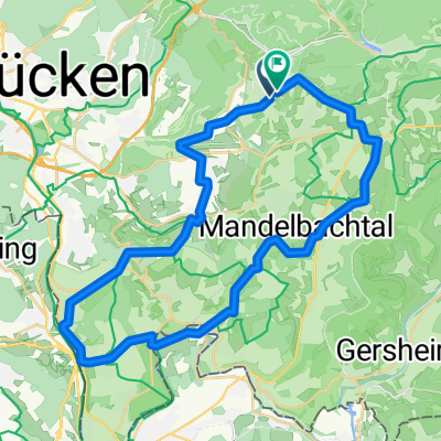
A cycling route starting in Sankt Ingbert, Saarland, Germany.
Overview
About this route
St. Ingberter RTF - 113 km
RTF des Radsportclub St. Ingbert e.V.
Alle weiteren Hinweise zu dieser Strecke -> hier anklicken
- -:--
- Duration
- 112.8 km
- Distance
- 1,320 m
- Ascent
- 1,309 m
- Descent
- ---
- Avg. speed
- 384 m
- Avg. speed
Route quality
Waytypes & surfaces along the route
Waytypes
Busy road
52.5 km
(47 %)
Road
40.3 km
(36 %)
Surfaces
Paved
78.5 km
(70 %)
Unpaved
0.3 km
(<1 %)
Asphalt
78.3 km
(69 %)
Gravel
0.3 km
(<1 %)
Route highlights
Points of interest along the route
Point of interest after 28 km
Kontrolle Hornbach
Point of interest after 55.8 km
Kontrolle Weiskirch
Point of interest after 92.1 km
Kontrolle Gersheim
Continue with Bikemap
Use, edit, or download this cycling route
You would like to ride St. Ingberter RTF des Radsportclub St. Ingbert e.V. - 113 km Strecke or customize it for your own trip? Here is what you can do with this Bikemap route:
Free features
- Save this route as favorite or in collections
- Copy & plan your own version of this route
- Sync your route with Garmin or Wahoo
Premium features
Free trial for 3 days, or one-time payment. More about Bikemap Premium.
- Navigate this route on iOS & Android
- Export a GPX / KML file of this route
- Create your custom printout (try it for free)
- Download this route for offline navigation
Discover more Premium features.
Get Bikemap PremiumFrom our community
Other popular routes starting in Sankt Ingbert
- Grüne PUR
- Distance
- 41.4 km
- Ascent
- 572 m
- Descent
- 572 m
- Location
- Sankt Ingbert, Saarland, Germany
- GPX Download: Radweg bei Blieskastel– Niederwürzbacher Weiher Runde von St. Ingbert
- Distance
- 75.7 km
- Ascent
- 251 m
- Descent
- 251 m
- Location
- Sankt Ingbert, Saarland, Germany
- Ins Lambsbachtal
- Distance
- 63.7 km
- Ascent
- 300 m
- Descent
- 300 m
- Location
- Sankt Ingbert, Saarland, Germany
- Corona-Tour
- Distance
- 58.3 km
- Ascent
- 323 m
- Descent
- 275 m
- Location
- Sankt Ingbert, Saarland, Germany
- IGB Kurz
- Distance
- 23 km
- Ascent
- 498 m
- Descent
- 497 m
- Location
- Sankt Ingbert, Saarland, Germany
- 7-Weiher-Tour
- Distance
- 28.7 km
- Ascent
- 288 m
- Descent
- 286 m
- Location
- Sankt Ingbert, Saarland, Germany
- Hüttenwanderweg
- Distance
- 11.9 km
- Ascent
- 449 m
- Descent
- 449 m
- Location
- Sankt Ingbert, Saarland, Germany
- 75km richtig rum
- Distance
- 73.3 km
- Ascent
- 200 m
- Descent
- 209 m
- Location
- Sankt Ingbert, Saarland, Germany