

PortuBici 18
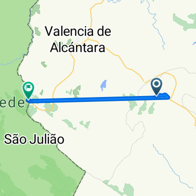
3. PortuBici 18. San Vicente de Alcántara-Castelo de Vide
A cycling route starting in San Vicente de Alcántara, Extremadura, Spain.
Overview
About this route
Valencia de Alcántara 0
La Fontañeda: 20,5
Monte de Baixo: 21,5
San Atnonio de Areias: 26,5
Marvao: 32
Portagen: 36,5
Castelo de Vide: 45,3
- -:--
- Duration
- 45.4 km
- Distance
- 690 m
- Ascent
- 626 m
- Descent
- ---
- Avg. speed
- ---
- Max. altitude
Part of
PortuBici 18
11 stages
Continue with Bikemap
Use, edit, or download this cycling route
You would like to ride 3. PortuBici 18. San Vicente de Alcántara-Castelo de Vide or customize it for your own trip? Here is what you can do with this Bikemap route:
Free features
- Save this route as favorite or in collections
- Copy & plan your own version of this route
- Sync your route with Garmin or Wahoo
Premium features
Free trial for 3 days, or one-time payment. More about Bikemap Premium.
- Navigate this route on iOS & Android
- Export a GPX / KML file of this route
- Create your custom printout (try it for free)
- Download this route for offline navigation
Discover more Premium features.
Get Bikemap PremiumFrom our community
Other popular routes starting in San Vicente de Alcántara
 T4 Portugal
- Distance
- 92.8 km
- Ascent
- 759 m
- Descent
- 871 m
- Location
- San Vicente de Alcántara, Extremadura, Spain
 De Travesía Pablo Iglesias a N-521
- Distance
- 18.4 km
- Ascent
- 175 m
- Descent
- 103 m
- Location
- San Vicente de Alcántara, Extremadura, Spain
 San Vicente - Talavera
- Distance
- 270.3 km
- Ascent
- 877 m
- Descent
- 1,007 m
- Location
- San Vicente de Alcántara, Extremadura, Spain
 SERRA SAO MAMEDE
- Distance
- 117.2 km
- Ascent
- 1,320 m
- Descent
- 1,320 m
- Location
- San Vicente de Alcántara, Extremadura, Spain
 De Calle Juan Rodríguez 42, San Vicente de Alcántara a Calle la Cruz 7, Cáceres
- Distance
- 82 km
- Ascent
- 979 m
- Descent
- 1,038 m
- Location
- San Vicente de Alcántara, Extremadura, Spain
 3. PortuBici 18. San Vicente de Alcántara-Castelo de Vide
- Distance
- 45.4 km
- Ascent
- 690 m
- Descent
- 626 m
- Location
- San Vicente de Alcántara, Extremadura, Spain
Open it in the app