
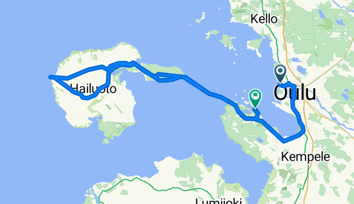
0039 EuroVelo 10 Day 21
A cycling route starting in Oulu, North Ostrobothnia, Finland.
Overview
About this route
We drove with our mobile home to Hailuoto with the lighthouse Marjaniemi and after that to Varjakka. Rain and thunderstorm during the day
- -:--
- Duration
- 111.8 km
- Distance
- 0 m
- Ascent
- 0 m
- Descent
- ---
- Avg. speed
- ---
- Max. altitude

Route quality
Waytypes & surfaces along the route
Waytypes
Cycleway
45.8 km
(41 %)
Track
25.7 km
(23 %)
Surfaces
Paved
58.1 km
(52 %)
Unpaved
25.7 km
(23 %)
Asphalt
53.7 km
(48 %)
Gravel
21.2 km
(19 %)
Continue with Bikemap
Use, edit, or download this cycling route
You would like to ride 0039 EuroVelo 10 Day 21 or customize it for your own trip? Here is what you can do with this Bikemap route:
Free features
- Save this route as favorite or in collections
- Copy & plan your own version of this route
- Split it into stages to create a multi-day tour
- Sync your route with Garmin or Wahoo
Premium features
Free trial for 3 days, or one-time payment. More about Bikemap Premium.
- Navigate this route on iOS & Android
- Export a GPX / KML file of this route
- Create your custom printout (try it for free)
- Download this route for offline navigation
Discover more Premium features.
Get Bikemap PremiumFrom our community
Other popular routes starting in Oulu
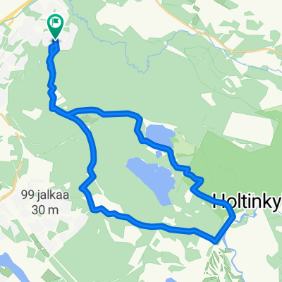 Talvikangas-Sanginjoki
- Distance
- 18.2 km
- Ascent
- 23 m
- Descent
- 21 m
- Location
- Oulu, North Ostrobothnia, Finland
 Tappa 28: Oulu-Simo
- Distance
- 91.4 km
- Ascent
- 0 m
- Descent
- 0 m
- Location
- Oulu, North Ostrobothnia, Finland
 oulu - keminmaa
- Distance
- 131 km
- Ascent
- 360 m
- Descent
- 354 m
- Location
- Oulu, North Ostrobothnia, Finland
 От Alppitie 2, Oulu до Irmantie 3, Oulu
- Distance
- 25.9 km
- Ascent
- 101 m
- Descent
- 98 m
- Location
- Oulu, North Ostrobothnia, Finland
 46. Oulu to Kemi
- Distance
- 123.1 km
- Ascent
- 195 m
- Descent
- 196 m
- Location
- Oulu, North Ostrobothnia, Finland
 Marionin kauha v2
- Distance
- 145 km
- Ascent
- 129 m
- Descent
- 129 m
- Location
- Oulu, North Ostrobothnia, Finland
 Tour de 2020
- Distance
- 906.6 km
- Ascent
- 608 m
- Descent
- 500 m
- Location
- Oulu, North Ostrobothnia, Finland
 pyhäjoki - oulu
- Distance
- 118.1 km
- Ascent
- 256 m
- Descent
- 259 m
- Location
- Oulu, North Ostrobothnia, Finland
Open it in the app