

180320_高知
A cycling route starting in Aki, Kochi, Japan.
Overview
About this route
- 9 h 16 min
- Duration
- 66.8 km
- Distance
- 2,019 m
- Ascent
- 2,025 m
- Descent
- 7.2 km/h
- Avg. speed
- ---
- Max. altitude

Route photos

Continue with Bikemap
Use, edit, or download this cycling route
You would like to ride 180320_高知 or customize it for your own trip? Here is what you can do with this Bikemap route:
Free features
- Save this route as favorite or in collections
- Copy & plan your own version of this route
- Sync your route with Garmin or Wahoo
Premium features
Free trial for 3 days, or one-time payment. More about Bikemap Premium.
- Navigate this route on iOS & Android
- Export a GPX / KML file of this route
- Create your custom printout (try it for free)
- Download this route for offline navigation
Discover more Premium features.
Get Bikemap PremiumFrom our community
Other popular routes starting in Aki
 shikoku trip day8
- Distance
- 44.7 km
- Ascent
- 122 m
- Descent
- 123 m
- Location
- Aki, Kochi, Japan
 Yasuchō Tei, Konan to 1930-1, Konan
- Distance
- 6.3 km
- Ascent
- 20 m
- Descent
- 64 m
- Location
- Aki, Kochi, Japan
 536-111, Konan to Yasuchō Tei, Konan
- Distance
- 2 km
- Ascent
- 61 m
- Descent
- 13 m
- Location
- Aki, Kochi, Japan
 Yasuchō Tei, Konan to Konan
- Distance
- 2.3 km
- Ascent
- 0 m
- Descent
- 54 m
- Location
- Aki, Kochi, Japan
 ゆずの里と慎太郎コース
- Distance
- 66.9 km
- Ascent
- 2,277 m
- Descent
- 2,278 m
- Location
- Aki, Kochi, Japan
 180320_高知
- Distance
- 66.8 km
- Ascent
- 2,019 m
- Descent
- 2,025 m
- Location
- Aki, Kochi, Japan
 Yasuchō Tei, Konan to 557-18, Konan
- Distance
- 2.2 km
- Ascent
- 4 m
- Descent
- 57 m
- Location
- Aki, Kochi, Japan
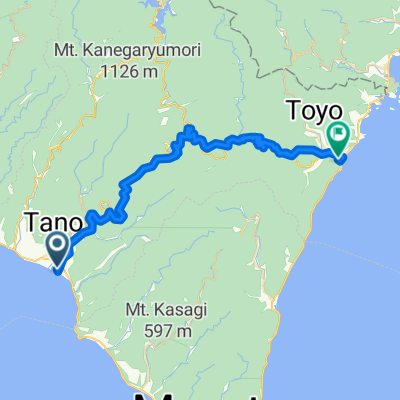 Tano toyo
- Distance
- 48.1 km
- Ascent
- 1,106 m
- Descent
- 1,104 m
- Location
- Aki, Kochi, Japan
Open it in the app