

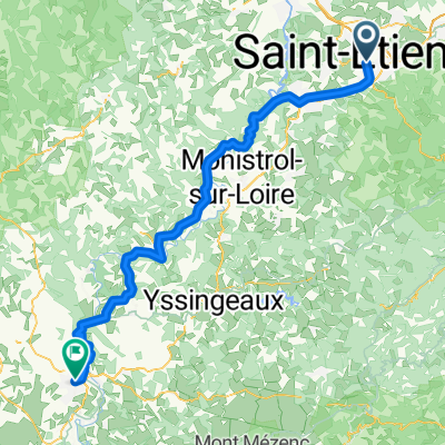
Balade-ociVELOcio-2018-A
A cycling route starting in Saint-Etienne, Auvergne-Rhône-Alpes, France.
Overview
About this route
- -:--
- Duration
- 11.2 km
- Distance
- 127 m
- Ascent
- 131 m
- Descent
- ---
- Avg. speed
- ---
- Max. altitude
Route quality
Waytypes & surfaces along the route
Waytypes
Quiet road
6.7 km
(61 %)
Access road
1.5 km
(14 %)
Surfaces
Paved
9.9 km
(89 %)
Unpaved
0.9 km
(8 %)
Asphalt
9.2 km
(82 %)
Gravel
0.6 km
(5 %)
Continue with Bikemap
Use, edit, or download this cycling route
You would like to ride Balade-ociVELOcio-2018-A or customize it for your own trip? Here is what you can do with this Bikemap route:
Free features
- Save this route as favorite or in collections
- Copy & plan your own version of this route
- Sync your route with Garmin or Wahoo
Premium features
Free trial for 3 days, or one-time payment. More about Bikemap Premium.
- Navigate this route on iOS & Android
- Export a GPX / KML file of this route
- Create your custom printout (try it for free)
- Download this route for offline navigation
Discover more Premium features.
Get Bikemap PremiumFrom our community
Other popular routes starting in Saint-Etienne
 GV19 st-étienne - le puy
- Distance
- 84.8 km
- Ascent
- 916 m
- Descent
- 828 m
- Location
- Saint-Etienne, Auvergne-Rhône-Alpes, France
 balade urbaine OciVelocio
- Distance
- 10.5 km
- Ascent
- 82 m
- Descent
- 81 m
- Location
- Saint-Etienne, Auvergne-Rhône-Alpes, France
 B: St.Étienne-Murat (Pas de Peyrol) 2.Etappe: Genf-Bordeaux:
- Distance
- 188.9 km
- Ascent
- 2,243 m
- Descent
- 1,732 m
- Location
- Saint-Etienne, Auvergne-Rhône-Alpes, France
 Retournac
- Distance
- 127.7 km
- Ascent
- 1,227 m
- Descent
- 1,245 m
- Location
- Saint-Etienne, Auvergne-Rhône-Alpes, France
 Circuit OT Euro 2016 V0
- Distance
- 9.5 km
- Ascent
- 74 m
- Descent
- 73 m
- Location
- Saint-Etienne, Auvergne-Rhône-Alpes, France
 Genf-Bordeaux, 2.Etappe: St. Etienne-Laviegerie (Murat)
- Distance
- 189.6 km
- Ascent
- 2,005 m
- Descent
- 1,410 m
- Location
- Saint-Etienne, Auvergne-Rhône-Alpes, France
 Balade-ociVELOcio-2018-A
- Distance
- 11.2 km
- Ascent
- 127 m
- Descent
- 131 m
- Location
- Saint-Etienne, Auvergne-Rhône-Alpes, France
 2016 Ride Day 141 - Saint-Etienne to Roanne
- Distance
- 96.1 km
- Ascent
- 432 m
- Descent
- 744 m
- Location
- Saint-Etienne, Auvergne-Rhône-Alpes, France
Open it in the app