

E 1 2018
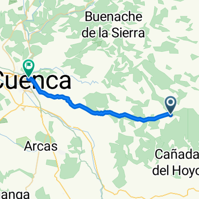
A cycling route starting in Cañada del Hoyo, Castille-La Mancha, Spain.
Overview
About this route
- -:--
- Duration
- 83.5 km
- Distance
- 920 m
- Ascent
- 566 m
- Descent
- ---
- Avg. speed
- ---
- Max. altitude

Route quality
Waytypes & surfaces along the route
Waytypes
Quiet road
30.9 km
(37 %)
Road
24.2 km
(29 %)
Undefined
28.4 km
(34 %)
Surfaces
Paved
25.9 km
(31 %)
Paved (undefined)
18.4 km
(22 %)
Asphalt
7.5 km
(9 %)
Undefined
57.6 km
(69 %)
Continue with Bikemap
Use, edit, or download this cycling route
You would like to ride E 1 2018 or customize it for your own trip? Here is what you can do with this Bikemap route:
Free features
- Save this route as favorite or in collections
- Copy & plan your own version of this route
- Split it into stages to create a multi-day tour
- Sync your route with Garmin or Wahoo
Premium features
Free trial for 3 days, or one-time payment. More about Bikemap Premium.
- Navigate this route on iOS & Android
- Export a GPX / KML file of this route
- Create your custom printout (try it for free)
- Download this route for offline navigation
Discover more Premium features.
Get Bikemap PremiumFrom our community
Other popular routes starting in Cañada del Hoyo
 Cañada vega
- Distance
- 87.5 km
- Ascent
- 1,152 m
- Descent
- 839 m
- Location
- Cañada del Hoyo, Castille-La Mancha, Spain
 cañada del pollo a Albarracin dura
- Distance
- 144.7 km
- Ascent
- 1,885 m
- Descent
- 1,756 m
- Location
- Cañada del Hoyo, Castille-La Mancha, Spain
 cañada serra
- Distance
- 201.6 km
- Ascent
- 1,266 m
- Descent
- 1,943 m
- Location
- Cañada del Hoyo, Castille-La Mancha, Spain
 Cañada del Hoyo - Cuenca
- Distance
- 22.9 km
- Ascent
- 223 m
- Descent
- 496 m
- Location
- Cañada del Hoyo, Castille-La Mancha, Spain

Etrex Touch®
Cañada del Hoyo Cycling- Distance
- 42.5 km
- Ascent
- 588 m
- Descent
- 579 m
- Location
- Cañada del Hoyo, Castille-La Mancha, Spain
 E 1 2018
- Distance
- 83.5 km
- Ascent
- 920 m
- Descent
- 566 m
- Location
- Cañada del Hoyo, Castille-La Mancha, Spain
 cañada del hoyo- albarracin VITOLE
- Distance
- 112.2 km
- Ascent
- 1,548 m
- Descent
- 1,359 m
- Location
- Cañada del Hoyo, Castille-La Mancha, Spain
Open it in the app