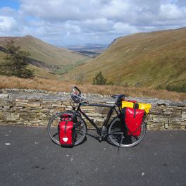
Basel - Passau
A cycling route starting in Birsfelden, Basel-Landschaft, Switzerland.
Overview
About this route
9 moderate bike stages in May 2017 along the Rhine from Basel to Lake Constance and further along the Danube to Passau, overnighting at campsites.
- -:--
- Duration
- 717.1 km
- Distance
- 765 m
- Ascent
- 718 m
- Descent
- ---
- Avg. speed
- ---
- Max. altitude
Route quality
Waytypes & surfaces along the route
Waytypes
Track
208 km
(29 %)
Quiet road
157.8 km
(22 %)
Surfaces
Paved
502 km
(70 %)
Unpaved
143.4 km
(20 %)
Asphalt
487.6 km
(68 %)
Gravel
100.4 km
(14 %)
Route highlights
Points of interest along the route
Point of interest after 0.1 km
Basel Bad. Bahnhof

Point of interest after 24.2 km
Camping Bachtalen, CH

Point of interest after 74.7 km
Camping Hochrhein, Kadelburg

Point of interest after 141.5 km
Camping Wangen

Point of interest after 205.9 km
Camping Wagenburg

Point of interest after 283.2 km
Camping Munderkingen

Point of interest after 356.6 km
Camping Gutshof Donauried

Point of interest after 458.1 km
Campingplatz beim Ruderclub, Neuburg

Point of interest after 538.5 km
Camping Kelheim Herrnsaal

Point of interest after 621.4 km
Campingplatz der Stadt Straubing

Point of interest after 714.6 km
Fahrradpension am Bahnhof, Passau
Continue with Bikemap
Use, edit, or download this cycling route
You would like to ride Basel - Passau or customize it for your own trip? Here is what you can do with this Bikemap route:
Free features
- Save this route as favorite or in collections
- Copy & plan your own version of this route
- Split it into stages to create a multi-day tour
- Sync your route with Garmin or Wahoo
Premium features
Free trial for 3 days, or one-time payment. More about Bikemap Premium.
- Navigate this route on iOS & Android
- Export a GPX / KML file of this route
- Create your custom printout (try it for free)
- Download this route for offline navigation
Discover more Premium features.
Get Bikemap PremiumFrom our community
Other popular routes starting in Birsfelden
 Basel-Muttenz-Gempen-Dornach-Basel
- Distance
- 36.1 km
- Ascent
- 574 m
- Descent
- 571 m
- Location
- Birsfelden, Basel-Landschaft, Switzerland
 Basel St. Jakob - Rund ums Gempenplateau
- Distance
- 47.9 km
- Ascent
- 922 m
- Descent
- 922 m
- Location
- Birsfelden, Basel-Landschaft, Switzerland
 Velo-Tour-Basel Schweizermaischterstadt
- Distance
- 15.7 km
- Ascent
- 74 m
- Descent
- 75 m
- Location
- Birsfelden, Basel-Landschaft, Switzerland
 Basel Laufen Basel
- Distance
- 53.9 km
- Ascent
- 287 m
- Descent
- 287 m
- Location
- Birsfelden, Basel-Landschaft, Switzerland
 kleine Gempenrunde
- Distance
- 35.4 km
- Ascent
- 1,086 m
- Descent
- 883 m
- Location
- Birsfelden, Basel-Landschaft, Switzerland
 Steinen-Schopfheim-Tegernau-Kandern
- Distance
- 64.5 km
- Ascent
- 516 m
- Descent
- 514 m
- Location
- Birsfelden, Basel-Landschaft, Switzerland
 Wartenberg lang
- Distance
- 16.3 km
- Ascent
- 239 m
- Descent
- 238 m
- Location
- Birsfelden, Basel-Landschaft, Switzerland
 Schweiztour 2010
- Distance
- 872.4 km
- Ascent
- 3,874 m
- Descent
- 3,874 m
- Location
- Birsfelden, Basel-Landschaft, Switzerland
Open it in the app


