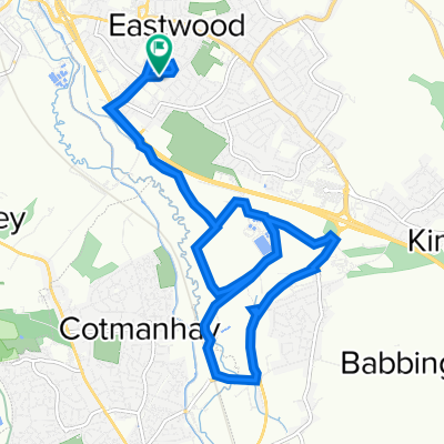
Eastwood Matlock
A cycling route starting in Eastwood, England, United Kingdom.
Overview
About this route
- -:--
- Duration
- 71.3 km
- Distance
- 607 m
- Ascent
- 593 m
- Descent
- ---
- Avg. speed
- ---
- Avg. speed
Route quality
Waytypes & surfaces along the route
Waytypes
Busy road
44 km
(62 %)
Quiet road
9.1 km
(13 %)
Surfaces
Paved
17.6 km
(25 %)
Unpaved
1.7 km
(2 %)
Asphalt
16.9 km
(24 %)
Gravel
1.3 km
(2 %)
Continue with Bikemap
Use, edit, or download this cycling route
You would like to ride Eastwood Matlock or customize it for your own trip? Here is what you can do with this Bikemap route:
Free features
- Save this route as favorite or in collections
- Copy & plan your own version of this route
- Sync your route with Garmin or Wahoo
Premium features
Free trial for 3 days, or one-time payment. More about Bikemap Premium.
- Navigate this route on iOS & Android
- Export a GPX / KML file of this route
- Create your custom printout (try it for free)
- Download this route for offline navigation
Discover more Premium features.
Get Bikemap PremiumFrom our community
Other popular routes starting in Eastwood
- Eastwood Matlock
- Distance
- 71.3 km
- Ascent
- 607 m
- Descent
- 593 m
- Location
- Eastwood, England, United Kingdom
- Bob-R1
- Distance
- 12 km
- Ascent
- 66 m
- Descent
- 68 m
- Location
- Eastwood, England, United Kingdom
- Sunday 291213-2
- Distance
- 3 km
- Ascent
- 11 m
- Descent
- 0 m
- Location
- Eastwood, England, United Kingdom
- Richmond Avenue 50 to Richmond Avenue 52
- Distance
- 22.1 km
- Ascent
- 223 m
- Descent
- 210 m
- Location
- Eastwood, England, United Kingdom
- 55 Bailey Grove Road, Nottingham to Ta Kfc, Enterprise Way, Nottingham
- Distance
- 0.7 km
- Ascent
- 0 m
- Descent
- 11 m
- Location
- Eastwood, England, United Kingdom
- Chapel Street 28, Eastwood to Derby Road 6, Eastwood
- Distance
- 1.7 km
- Ascent
- 39 m
- Descent
- 15 m
- Location
- Eastwood, England, United Kingdom
- Tinsley Road, Eastwood to Makeney Road, Duffield
- Distance
- 27.1 km
- Ascent
- 520 m
- Descent
- 532 m
- Location
- Eastwood, England, United Kingdom
- Plumptre Way 14, Eastwood to Plumptre Way 14, Eastwood
- Distance
- 10.4 km
- Ascent
- 49 m
- Descent
- 53 m
- Location
- Eastwood, England, United Kingdom
Open it in the app