

Going to the beach
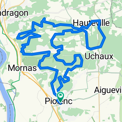
A cycling route starting in Piolenc, Provence-Alpes-Côte d'Azur Region, France.
Overview
About this route
From the Garlic Village to the sea...
- -:--
- Duration
- 149.2 km
- Distance
- 175 m
- Ascent
- 201 m
- Descent
- ---
- Avg. speed
- ---
- Max. altitude

Continue with Bikemap
Use, edit, or download this cycling route
You would like to ride Going to the beach or customize it for your own trip? Here is what you can do with this Bikemap route:
Free features
- Save this route as favorite or in collections
- Copy & plan your own version of this route
- Split it into stages to create a multi-day tour
- Sync your route with Garmin or Wahoo
Premium features
Free trial for 3 days, or one-time payment. More about Bikemap Premium.
- Navigate this route on iOS & Android
- Export a GPX / KML file of this route
- Create your custom printout (try it for free)
- Download this route for offline navigation
Discover more Premium features.
Get Bikemap PremiumFrom our community
Other popular routes starting in Piolenc
 PIOLENC 49 KM
- Distance
- 49.5 km
- Ascent
- 769 m
- Descent
- 771 m
- Location
- Piolenc, Provence-Alpes-Côte d'Azur Region, France
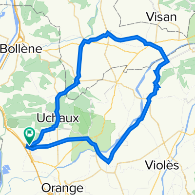
 Orange Via Venaissia 140km hin und zurück
- Distance
- 68.2 km
- Ascent
- 265 m
- Descent
- 156 m
- Location
- Piolenc, Provence-Alpes-Côte d'Azur Region, France
 PIOLENC 44KM
- Distance
- 44.3 km
- Ascent
- 668 m
- Descent
- 667 m
- Location
- Piolenc, Provence-Alpes-Côte d'Azur Region, France
 PIOLENC 36KM
- Distance
- 35.8 km
- Ascent
- 589 m
- Descent
- 620 m
- Location
- Piolenc, Provence-Alpes-Côte d'Azur Region, France
 PIOLENC 41 KM
- Distance
- 41.3 km
- Ascent
- 530 m
- Descent
- 526 m
- Location
- Piolenc, Provence-Alpes-Côte d'Azur Region, France
 Route à grande vitesse
- Distance
- 47.2 km
- Ascent
- 148 m
- Descent
- 147 m
- Location
- Piolenc, Provence-Alpes-Côte d'Azur Region, France
 Going to the beach
- Distance
- 149.2 km
- Ascent
- 175 m
- Descent
- 201 m
- Location
- Piolenc, Provence-Alpes-Côte d'Azur Region, France
 tour du débat
- Distance
- 55 km
- Ascent
- 354 m
- Descent
- 354 m
- Location
- Piolenc, Provence-Alpes-Côte d'Azur Region, France
Open it in the app