

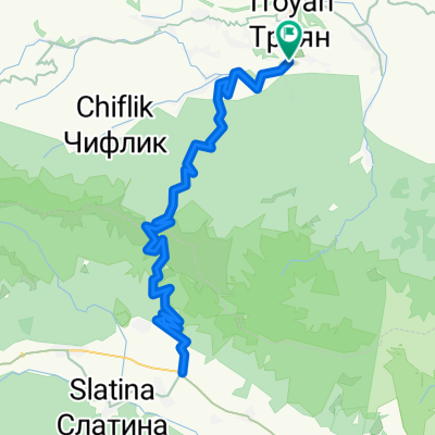
Orešak - Černa Mogyla
A cycling route starting in Troyan Municipality, Lovech, Bulgaria.
Overview
About this route
vybeh na vrchol Černa Mogyla, polovica cesty asfalt, potom les
- -:--
- Duration
- 20.5 km
- Distance
- 1,229 m
- Ascent
- 108 m
- Descent
- ---
- Avg. speed
- ---
- Max. altitude

Route quality
Waytypes & surfaces along the route
Waytypes
Quiet road
8.5 km
(42 %)
Track
5.6 km
(28 %)
Surfaces
Unpaved
3.7 km
(18 %)
Ground
3 km
(15 %)
Gravel
0.7 km
(3 %)
Undefined
16.7 km
(82 %)
Continue with Bikemap
Use, edit, or download this cycling route
You would like to ride Orešak - Černa Mogyla or customize it for your own trip? Here is what you can do with this Bikemap route:
Free features
- Save this route as favorite or in collections
- Copy & plan your own version of this route
- Sync your route with Garmin or Wahoo
Premium features
Free trial for 3 days, or one-time payment. More about Bikemap Premium.
- Navigate this route on iOS & Android
- Export a GPX / KML file of this route
- Create your custom printout (try it for free)
- Download this route for offline navigation
Discover more Premium features.
Get Bikemap PremiumFrom our community
Other popular routes starting in Troyan Municipality
 d3 - Beklemeto-Uzana - Kom-Emine RBBtB
- Distance
- 72.9 km
- Ascent
- 2,984 m
- Descent
- 3,273 m
- Location
- Troyan Municipality, Lovech, Bulgaria
 ХС Чифлика-дълго
- Distance
- 18 km
- Ascent
- 603 m
- Descent
- 603 m
- Location
- Troyan Municipality, Lovech, Bulgaria
 Troyan - Karnare - Troyan
- Distance
- 93.3 km
- Ascent
- 2,062 m
- Descent
- 2,062 m
- Location
- Troyan Municipality, Lovech, Bulgaria
 Orešak - Černa Mogyla
- Distance
- 20.5 km
- Ascent
- 1,229 m
- Descent
- 108 m
- Location
- Troyan Municipality, Lovech, Bulgaria
 bikleme
- Distance
- 18.3 km
- Ascent
- 1,304 m
- Descent
- 296 m
- Location
- Troyan Municipality, Lovech, Bulgaria
 Беклемето-х.Козя стена
- Distance
- 8.3 km
- Ascent
- 254 m
- Descent
- 247 m
- Location
- Troyan Municipality, Lovech, Bulgaria
 TCRno7 CP1 to CP2 (M1)
- Distance
- 392.7 km
- Ascent
- 2,800 m
- Descent
- 4,017 m
- Location
- Troyan Municipality, Lovech, Bulgaria
 Tour of Bulgaria - III. Stage - Troyan - Gabrovo
- Distance
- 99.6 km
- Ascent
- 632 m
- Descent
- 582 m
- Location
- Troyan Municipality, Lovech, Bulgaria
Open it in the app