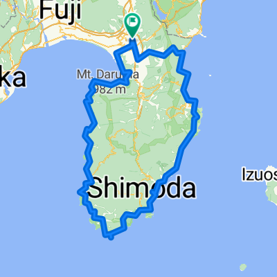
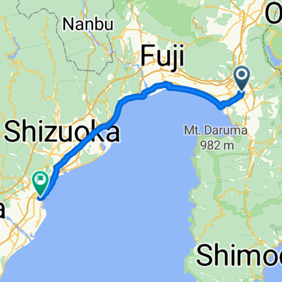
Aming伊豆D2 三島-堂ヶ島
A cycling route starting in Mishima, Shizuoka, Japan.
Overview
About this route
- -:--
 - Duration
 - 73.4 km
 - Distance
 - 931 m
 - Ascent
 - 927 m
 - Descent
 - ---
 - Avg. speed
 - ---
 - Max. altitude
 
Continue with Bikemap
Use, edit, or download this cycling route
You would like to ride Aming伊豆D2 三島-堂ヶ島 or customize it for your own trip? Here is what you can do with this Bikemap route:
Free features
- Save this route as favorite or in collections
 - Copy & plan your own version of this route
 - Sync your route with Garmin or Wahoo
 
Premium features
Free trial for 3 days, or one-time payment. More about Bikemap Premium.
- Navigate this route on iOS & Android
 - Export a GPX / KML file of this route
 - Create your custom printout (try it for free)
 - Download this route for offline navigation
 
Discover more Premium features.
Get Bikemap PremiumFrom our community
Other popular routes starting in Mishima
1-chōme to 18-1- Distance
 - 66 km
 - Ascent
 - 312 m
 - Descent
 - 328 m
 - Location
 - Mishima, Shizuoka, Japan
 
2011-08-10中伊豆修善寺- Distance
 - 29.8 km
 - Ascent
 - 200 m
 - Descent
 - 199 m
 - Location
 - Mishima, Shizuoka, Japan
 
Day 11:Izunagaoka-Shimoda- Distance
 - 110.9 km
 - Ascent
 - 3,848 m
 - Descent
 - 3,856 m
 - Location
 - Mishima, Shizuoka, Japan
 
11, 三島市 まで1丁目 21, 三島市- Distance
 - 3.2 km
 - Ascent
 - 7 m
 - Descent
 - 126 m
 - Location
 - Mishima, Shizuoka, Japan
 
Isaiah's Climb- Distance
 - 66.8 km
 - Ascent
 - 1,384 m
 - Descent
 - 1,385 m
 - Location
 - Mishima, Shizuoka, Japan
 
7, 三島市 まで10−3, 三島市- Distance
 - 60.1 km
 - Ascent
 - 810 m
 - Descent
 - 833 m
 - Location
 - Mishima, Shizuoka, Japan
 
to 東府や- Distance
 - 74.8 km
 - Ascent
 - 372 m
 - Descent
 - 369 m
 - Location
 - Mishima, Shizuoka, Japan
 
2016Tour-Mishima- Distance
 - 77.3 km
 - Ascent
 - 236 m
 - Descent
 - 281 m
 - Location
 - Mishima, Shizuoka, Japan
 
Open it in the app


