

Paganico-S.Antimo-Villa a Tolli-Civitella Paganico FS
A cycling route starting in Campagnatico, Tuscany, Italy.
Overview
About this route
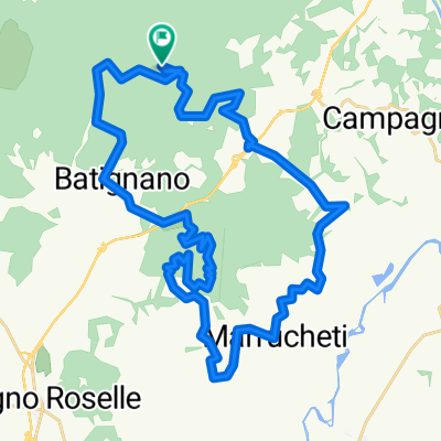
Si raggiunge S:Antimo con tratto sterrato da S.Angelo Scalo. Si sale verso Montalcino passando per Villa a Tolli, si ridiscende per Ventolaio, poi S.Angelo in Colle per arrivare alla stazione di Civitella Paganico.
- -:--
- Duration
- 66.5 km
- Distance
- 892 m
- Ascent
- 886 m
- Descent
- ---
- Avg. speed
- ---
- Avg. speed
Route quality
Waytypes & surfaces along the route
Waytypes
Busy road
30.3 km
(46 %)
Track
17.7 km
(27 %)
Surfaces
Paved
22.8 km
(34 %)
Unpaved
27 km
(41 %)
Asphalt
22.8 km
(34 %)
Gravel
12.2 km
(18 %)
Continue with Bikemap
Use, edit, or download this cycling route
You would like to ride Paganico-S.Antimo-Villa a Tolli-Civitella Paganico FS or customize it for your own trip? Here is what you can do with this Bikemap route:
Free features
- Save this route as favorite or in collections
- Copy & plan your own version of this route
- Sync your route with Garmin or Wahoo
Premium features
Free trial for 3 days, or one-time payment. More about Bikemap Premium.
- Navigate this route on iOS & Android
- Export a GPX / KML file of this route
- Create your custom printout (try it for free)
- Download this route for offline navigation
Discover more Premium features.
Get Bikemap PremiumFrom our community
Other popular routes starting in Campagnatico
 colombaio nave
- Distance
- 43.9 km
- Ascent
- 940 m
- Descent
- 938 m
- Location
- Campagnatico, Tuscany, Italy
 Poggi del Sasso - Sant'Antonio - Arcille - Preselle - Montorgiali - Pancole - Scansano - Magliano in Toscana
- Distance
- 63.5 km
- Ascent
- 481 m
- Descent
- 687 m
- Location
- Campagnatico, Tuscany, Italy
 montemasi
- Distance
- 83.4 km
- Ascent
- 1,332 m
- Descent
- 1,329 m
- Location
- Campagnatico, Tuscany, Italy
 Paganico-S.Antimo-Villa a Tolli-Civitella Paganico FS
- Distance
- 66.5 km
- Ascent
- 892 m
- Descent
- 886 m
- Location
- Campagnatico, Tuscany, Italy
 C. Paganico - Campagnatico - Pianetto - Arcille - Preselle - Montorgiali - Pancole - Scansano - Magliano in Toscana
- Distance
- 60.2 km
- Ascent
- 857 m
- Descent
- 825 m
- Location
- Campagnatico, Tuscany, Italy
 Cinigianese-Paganico-Montorsaio-Campagnatico
- Distance
- 71 km
- Ascent
- 901 m
- Descent
- 891 m
- Location
- Campagnatico, Tuscany, Italy
 MTBO Toscana 2011-5
- Distance
- 137.7 km
- Ascent
- 639 m
- Descent
- 631 m
- Location
- Campagnatico, Tuscany, Italy
 Paganico 133
- Distance
- 132.6 km
- Ascent
- 1,551 m
- Descent
- 1,551 m
- Location
- Campagnatico, Tuscany, Italy
Open it in the app