
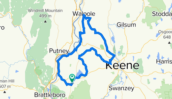
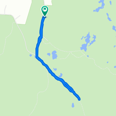
Chesterfield - Walpole NH
A cycling route starting in Chesterfield, New Hampshire, United States of America.
Overview
About this route
Mostly quiet roads. Rolling with a few good climbs. Food in Westmoreland, Keene & Walpole.
- -:--
- Duration
- 81.5 km
- Distance
- 1,035 m
- Ascent
- 1,155 m
- Descent
- ---
- Avg. speed
- 418 m
- Max. altitude
Route quality
Waytypes & surfaces along the route
Waytypes
Quiet road
61.2 km
(75 %)
Busy road
8.5 km
(10 %)
Surfaces
Paved
45.7 km
(56 %)
Unpaved
1.6 km
(2 %)
Asphalt
44.2 km
(54 %)
Paved (undefined)
1.5 km
(2 %)
Continue with Bikemap
Use, edit, or download this cycling route
You would like to ride Chesterfield - Walpole NH or customize it for your own trip? Here is what you can do with this Bikemap route:
Free features
- Save this route as favorite or in collections
- Copy & plan your own version of this route
- Split it into stages to create a multi-day tour
- Sync your route with Garmin or Wahoo
Premium features
Free trial for 3 days, or one-time payment. More about Bikemap Premium.
- Navigate this route on iOS & Android
- Export a GPX / KML file of this route
- Create your custom printout (try it for free)
- Download this route for offline navigation
Discover more Premium features.
Get Bikemap PremiumFrom our community
Other popular routes starting in Chesterfield
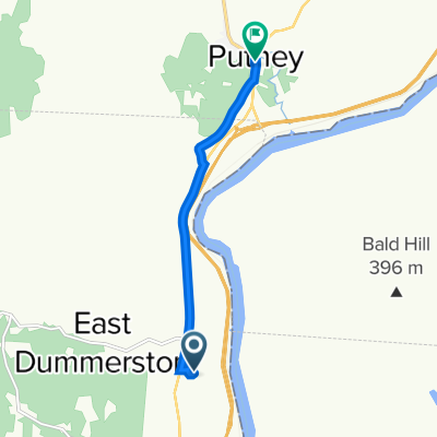 East Dummerston to 119 Main St, East Dummerston
- Distance
- 5.9 km
- Ascent
- 70 m
- Descent
- 69 m
- Location
- Chesterfield, New Hampshire, United States of America
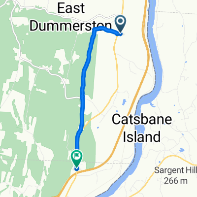 1238 Calvin Coolidge Memorial Hwy, East Dummerston to 1500–1556 Putney Rd, Brattleboro
- Distance
- 5.2 km
- Ascent
- 88 m
- Descent
- 113 m
- Location
- Chesterfield, New Hampshire, United States of America
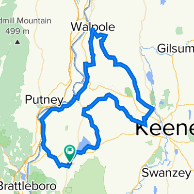 Chesterfield - Walpole NH
- Distance
- 81.5 km
- Ascent
- 1,035 m
- Descent
- 1,155 m
- Location
- Chesterfield, New Hampshire, United States of America
 Short ride through Chesterfield
- Distance
- 4.2 km
- Ascent
- 95 m
- Descent
- 92 m
- Location
- Chesterfield, New Hampshire, United States of America
Open it in the app