

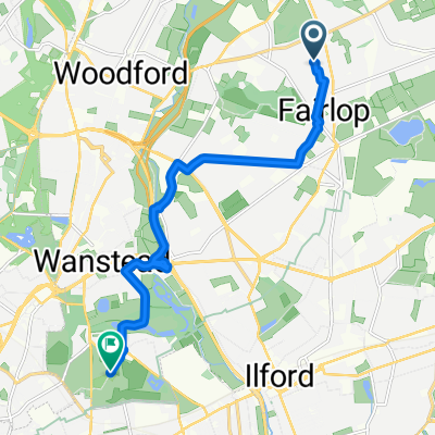
Loughton
A cycling route starting in Grange Hill, England, United Kingdom.
Overview
About this route
- -:--
- Duration
- 8.3 km
- Distance
- 69 m
- Ascent
- 73 m
- Descent
- ---
- Avg. speed
- ---
- Max. altitude

Continue with Bikemap
Use, edit, or download this cycling route
You would like to ride Loughton or customize it for your own trip? Here is what you can do with this Bikemap route:
Free features
- Save this route as favorite or in collections
- Copy & plan your own version of this route
- Sync your route with Garmin or Wahoo
Premium features
Free trial for 3 days, or one-time payment. More about Bikemap Premium.
- Navigate this route on iOS & Android
- Export a GPX / KML file of this route
- Create your custom printout (try it for free)
- Download this route for offline navigation
Discover more Premium features.
Get Bikemap PremiumFrom our community
Other popular routes starting in Grange Hill
 6 Fullwell Court, Fullwell Ave, Ilford to 36 Chapelmount Road, London
- Distance
- 3.5 km
- Ascent
- 38 m
- Descent
- 29 m
- Location
- Grange Hill, England, United Kingdom
 OTH quick route
- Distance
- 22.2 km
- Ascent
- 198 m
- Descent
- 197 m
- Location
- Grange Hill, England, United Kingdom
 wanstead
- Distance
- 9.9 km
- Ascent
- 18 m
- Descent
- 64 m
- Location
- Grange Hill, England, United Kingdom
 ig6 to W2
- Distance
- 25.3 km
- Ascent
- 20 m
- Descent
- 30 m
- Location
- Grange Hill, England, United Kingdom
 15 Colvin Gardens to High Elms, Woodford Green
- Distance
- 5.2 km
- Ascent
- 83 m
- Descent
- 57 m
- Location
- Grange Hill, England, United Kingdom
 16 Cumberland Close, Ilford to 68 Hainault Road, Chigwell
- Distance
- 2.9 km
- Ascent
- 41 m
- Descent
- 24 m
- Location
- Grange Hill, England, United Kingdom
 Loughton
- Distance
- 8.3 km
- Ascent
- 69 m
- Descent
- 73 m
- Location
- Grange Hill, England, United Kingdom
 Upminster
- Distance
- 16.7 km
- Ascent
- 59 m
- Descent
- 92 m
- Location
- Grange Hill, England, United Kingdom
Open it in the app