

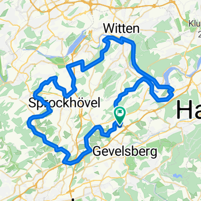
Sonntag, d. 08.04.2018
A cycling route starting in Gevelsberg, North Rhine-Westphalia, Germany.
Overview
About this route
- -:--
- Duration
- 57.4 km
- Distance
- 715 m
- Ascent
- 709 m
- Descent
- ---
- Avg. speed
- ---
- Max. altitude

Route quality
Waytypes & surfaces along the route
Waytypes
Track
19.5 km
(34 %)
Quiet road
10.9 km
(19 %)
Surfaces
Paved
27.6 km
(48 %)
Unpaved
20.7 km
(36 %)
Asphalt
26.4 km
(46 %)
Gravel
13.8 km
(24 %)
Continue with Bikemap
Use, edit, or download this cycling route
You would like to ride Sonntag, d. 08.04.2018 or customize it for your own trip? Here is what you can do with this Bikemap route:
Free features
- Save this route as favorite or in collections
- Copy & plan your own version of this route
- Sync your route with Garmin or Wahoo
Premium features
Free trial for 3 days, or one-time payment. More about Bikemap Premium.
- Navigate this route on iOS & Android
- Export a GPX / KML file of this route
- Create your custom printout (try it for free)
- Download this route for offline navigation
Discover more Premium features.
Get Bikemap PremiumFrom our community
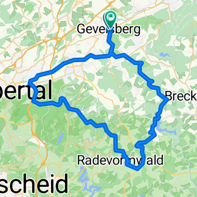
Other popular routes starting in Gevelsberg
 16. Talsperrenrundfahrt (70km Strecke)
- Distance
- 69.8 km
- Ascent
- 1,027 m
- Descent
- 1,017 m
- Location
- Gevelsberg, North Rhine-Westphalia, Germany
 APM-Nordbahntrasse-Ruhrtal
- Distance
- 119.6 km
- Ascent
- 481 m
- Descent
- 483 m
- Location
- Gevelsberg, North Rhine-Westphalia, Germany
 RTF Tour de Ruhr - 71km
- Distance
- 65.5 km
- Ascent
- 662 m
- Descent
- 662 m
- Location
- Gevelsberg, North Rhine-Westphalia, Germany
 71km RTF Tour de Ruhr 2011
- Distance
- 65.3 km
- Ascent
- 716 m
- Descent
- 718 m
- Location
- Gevelsberg, North Rhine-Westphalia, Germany
 KohlenbahnRadweg
- Distance
- 8 km
- Ascent
- 91 m
- Descent
- 70 m
- Location
- Gevelsberg, North Rhine-Westphalia, Germany
 Kleine Rund Gevelsberg/Wtal/Rade/Ennepetal
- Distance
- 57.2 km
- Ascent
- 410 m
- Descent
- 413 m
- Location
- Gevelsberg, North Rhine-Westphalia, Germany
 2009.07.05 Gevelsberg
- Distance
- 37.9 km
- Ascent
- 603 m
- Descent
- 603 m
- Location
- Gevelsberg, North Rhine-Westphalia, Germany
 Rund tour zur kemnade hattingen und über die bahn trasse
- Distance
- 60.8 km
- Ascent
- 443 m
- Descent
- 443 m
- Location
- Gevelsberg, North Rhine-Westphalia, Germany
Open it in the app