

2019 10km Vr A4DHld dag 4
A cycling route starting in Hoogland, Utrecht, The Netherlands.
Overview
About this route
L Engweg, L Luistergang, R Molenpad, L Enkeerdpad, R Hoolesteeg, R Schothorsterlaan, L Winkelpad, Oversteken en R Hamseweg , L Boetzelaerlaan, Oversteken Boetzelaarlaan , Langs fietspad Bunschoterstraat, R fietspad naar de opstelplaats Kabof:
Start Intocht 19:45 uur. R Bieshaarlaan , L Kraailandhof, Oversteken Zevenhuizerstraat, L Berkenlaan, R Kerklaan, R Engweg, Einde intocht bij Paardensportterrein.
- -:--
- Duration
- 7 km
- Distance
- 11 m
- Ascent
- 12 m
- Descent
- ---
- Avg. speed
- ---
- Max. altitude

Route quality
Waytypes & surfaces along the route
Waytypes
Quiet road
4.2 km
(60 %)
Cycleway
2.6 km
(37 %)
Surfaces
Paved
3 km
(42 %)
Asphalt
3 km
(42 %)
Undefined
4.1 km
(58 %)
Continue with Bikemap
Use, edit, or download this cycling route
You would like to ride 2019 10km Vr A4DHld dag 4 or customize it for your own trip? Here is what you can do with this Bikemap route:
Free features
- Save this route as favorite or in collections
- Copy & plan your own version of this route
- Sync your route with Garmin or Wahoo
Premium features
Free trial for 3 days, or one-time payment. More about Bikemap Premium.
- Navigate this route on iOS & Android
- Export a GPX / KML file of this route
- Create your custom printout (try it for free)
- Download this route for offline navigation
Discover more Premium features.
Get Bikemap PremiumFrom our community
Other popular routes starting in Hoogland
 Rondje Vrijdag 16 aug 2013
- Distance
- 33.5 km
- Ascent
- 0 m
- Descent
- 0 m
- Location
- Hoogland, Utrecht, The Netherlands
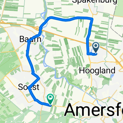 From Amersfoort to Soest
- Distance
- 18.4 km
- Ascent
- 27 m
- Descent
- 21 m
- Location
- Hoogland, Utrecht, The Netherlands
 Testroute 67km
- Distance
- 67.5 km
- Ascent
- 69 m
- Descent
- 68 m
- Location
- Hoogland, Utrecht, The Netherlands
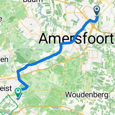 Gagelgat, Hooglanderveen naar Hoog Kanje, Zeist
- Distance
- 23 km
- Ascent
- 100 m
- Descent
- 98 m
- Location
- Hoogland, Utrecht, The Netherlands
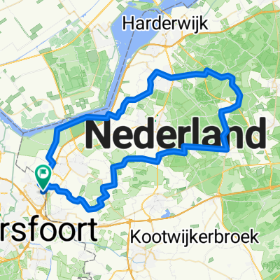
 Amersfoort-Amerongseberg-Amersfoort
- Distance
- 61.5 km
- Ascent
- 98 m
- Descent
- 96 m
- Location
- Hoogland, Utrecht, The Netherlands
 Client map
- Distance
- 35 km
- Ascent
- 5 m
- Descent
- 5 m
- Location
- Hoogland, Utrecht, The Netherlands
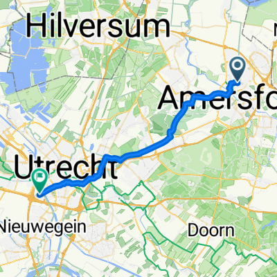 naar werk snelste route
- Distance
- 29.2 km
- Ascent
- 87 m
- Descent
- 91 m
- Location
- Hoogland, Utrecht, The Netherlands
 het 2 uurtje
- Distance
- 55.3 km
- Ascent
- 20 m
- Descent
- 20 m
- Location
- Hoogland, Utrecht, The Netherlands
Open it in the app