

EU - Bleibtreusee - EU
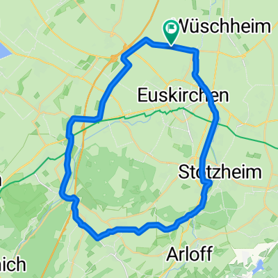
A cycling route starting in Euskirchen, North Rhine-Westphalia, Germany.
Overview
About this route
Accurate route recorded with Garmin to Badesess Bleibtreusee. Some forest sections. Very varied. Give it a try.
- -:--
- Duration
- 58.1 km
- Distance
- 131 m
- Ascent
- 151 m
- Descent
- ---
- Avg. speed
- 164 m
- Max. altitude

Route quality
Waytypes & surfaces along the route
Waytypes
Track
32.6 km
(56 %)
Quiet road
9.9 km
(17 %)
Surfaces
Paved
40.1 km
(69 %)
Unpaved
11 km
(19 %)
Asphalt
31.4 km
(54 %)
Paved (undefined)
8.7 km
(15 %)
Continue with Bikemap
Use, edit, or download this cycling route
You would like to ride EU - Bleibtreusee - EU or customize it for your own trip? Here is what you can do with this Bikemap route:
Free features
- Save this route as favorite or in collections
- Copy & plan your own version of this route
- Sync your route with Garmin or Wahoo
Premium features
Free trial for 3 days, or one-time payment. More about Bikemap Premium.
- Navigate this route on iOS & Android
- Export a GPX / KML file of this route
- Create your custom printout (try it for free)
- Download this route for offline navigation
Discover more Premium features.
Get Bikemap PremiumFrom our community
Other popular routes starting in Euskirchen
 Rund um Euskirchen
- Distance
- 28.7 km
- Ascent
- 122 m
- Descent
- 117 m
- Location
- Euskirchen, North Rhine-Westphalia, Germany
 EU-Bad Münstereifel-Mechernich: Waldtour
- Distance
- 43.1 km
- Ascent
- 413 m
- Descent
- 404 m
- Location
- Euskirchen, North Rhine-Westphalia, Germany
 EU-Abendroute (westlich EU)
- Distance
- 20.4 km
- Ascent
- 93 m
- Descent
- 91 m
- Location
- Euskirchen, North Rhine-Westphalia, Germany
 EU-BAM-Forstgebiete-Arloff-EU
- Distance
- 39.1 km
- Ascent
- 290 m
- Descent
- 291 m
- Location
- Euskirchen, North Rhine-Westphalia, Germany
 Von EU ums BM-Tal
- Distance
- 35.6 km
- Ascent
- 415 m
- Descent
- 423 m
- Location
- Euskirchen, North Rhine-Westphalia, Germany
 EU - Bleibtreusee - EU
- Distance
- 58.1 km
- Ascent
- 131 m
- Descent
- 151 m
- Location
- Euskirchen, North Rhine-Westphalia, Germany
 Kloster Schweinheim
- Distance
- 21.5 km
- Ascent
- 134 m
- Descent
- 136 m
- Location
- Euskirchen, North Rhine-Westphalia, Germany
 MTB tour der hoffnung ca. 48KM 800HM
- Distance
- 47.5 km
- Ascent
- 682 m
- Descent
- 689 m
- Location
- Euskirchen, North Rhine-Westphalia, Germany
Open it in the app