

Overview
About this route
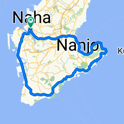
- -:--
- Duration
- 77.1 km
- Distance
- 241 m
- Ascent
- 239 m
- Descent
- ---
- Avg. speed
- ---
- Max. altitude

Part of
Okinawa Bike
5 stages
Continue with Bikemap
Use, edit, or download this cycling route
You would like to ride Okinawa Bike Day1 or customize it for your own trip? Here is what you can do with this Bikemap route:
Free features
- Save this route as favorite or in collections
- Copy & plan your own version of this route
- Sync your route with Garmin or Wahoo
Premium features
Free trial for 3 days, or one-time payment. More about Bikemap Premium.
- Navigate this route on iOS & Android
- Export a GPX / KML file of this route
- Create your custom printout (try it for free)
- Download this route for offline navigation
Discover more Premium features.
Get Bikemap PremiumFrom our community
Other popular routes starting in Naha
 Project L&P, Okinawa 2010
- Distance
- 208.2 km
- Ascent
- 619 m
- Descent
- 619 m
- Location
- Naha, Okinawa, Japan
 Okinawa
- Distance
- 97.8 km
- Ascent
- 285 m
- Descent
- 283 m
- Location
- Naha, Okinawa, Japan
 沖繩2017_WHOLE
- Distance
- 486.3 km
- Ascent
- 1,054 m
- Descent
- 1,056 m
- Location
- Naha, Okinawa, Japan
 沖繩_Day 1
- Distance
- 53.9 km
- Ascent
- 239 m
- Descent
- 246 m
- Location
- Naha, Okinawa, Japan
 2016 OKINAWA Trip DAY 4
- Distance
- 53.1 km
- Ascent
- 471 m
- Descent
- 472 m
- Location
- Naha, Okinawa, Japan
 Okinawa Bike Day1
- Distance
- 77.1 km
- Ascent
- 241 m
- Descent
- 239 m
- Location
- Naha, Okinawa, Japan
 Okinawa Cycling Trip Day Five
- Distance
- 60.6 km
- Ascent
- 267 m
- Descent
- 268 m
- Location
- Naha, Okinawa, Japan
 Tour de Okinawa Day 1
- Distance
- 80.1 km
- Ascent
- 270 m
- Descent
- 278 m
- Location
- Naha, Okinawa, Japan
Open it in the app