

Suèvres-Candé entlang der Loire
A cycling route starting in Mer, Centre-Val de Loire, France.
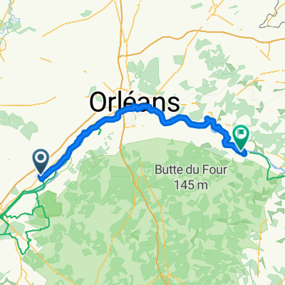
Overview
About this route
- -:--
- Duration
- 73.1 km
- Distance
- 92 m
- Ascent
- 87 m
- Descent
- ---
- Avg. speed
- ---
- Max. altitude

Route quality
Waytypes & surfaces along the route
Waytypes
Path
22.8 km
(31 %)
Quiet road
22.3 km
(30 %)
Surfaces
Paved
25.5 km
(35 %)
Unpaved
8.7 km
(12 %)
Asphalt
16.5 km
(23 %)
Concrete
4.9 km
(7 %)
Route highlights
Points of interest along the route
Point of interest after 9.6 km
Saint Dyé
Point of interest after 33.3 km
Chateau de la Pigeonnière
Point of interest after 33.5 km
Chateau du Plessis-Villelouet
Point of interest after 35.4 km
Chateau de Madon
Point of interest after 39.1 km
Chateau de Candé
Point of interest after 62.2 km
Chateau de Ménars
Point of interest after 63.9 km
Chateau de Coure sur Loire
Point of interest after 63.9 km
Saint Vincent et Sainte Radegonde
Continue with Bikemap
Use, edit, or download this cycling route
You would like to ride Suèvres-Candé entlang der Loire or customize it for your own trip? Here is what you can do with this Bikemap route:
Free features
- Save this route as favorite or in collections
- Copy & plan your own version of this route
- Sync your route with Garmin or Wahoo
Premium features
Free trial for 3 days, or one-time payment. More about Bikemap Premium.
- Navigate this route on iOS & Android
- Export a GPX / KML file of this route
- Create your custom printout (try it for free)
- Download this route for offline navigation
Discover more Premium features.
Get Bikemap PremiumFrom our community
Other popular routes starting in Mer
 Voyage 2008 : Mer - Le croisic
- Distance
- 492.5 km
- Ascent
- 227 m
- Descent
- 302 m
- Location
- Mer, Centre-Val de Loire, France
 Mer - Vierzon
- Distance
- 92.8 km
- Ascent
- 277 m
- Descent
- 250 m
- Location
- Mer, Centre-Val de Loire, France
 Suevrés nach Chambord
- Distance
- 14.2 km
- Ascent
- 13 m
- Descent
- 14 m
- Location
- Mer, Centre-Val de Loire, France
 13/07/09 : Mer - Sully/Loire
- Distance
- 102.1 km
- Ascent
- 101 m
- Descent
- 77 m
- Location
- Mer, Centre-Val de Loire, France
 Boucle Bords de Loire Blois-Gare de Mer - étape 2
- Distance
- 17.9 km
- Ascent
- 35 m
- Descent
- 46 m
- Location
- Mer, Centre-Val de Loire, France
 Chambord Cheverny Cellettes Blois
- Distance
- 82.8 km
- Ascent
- 200 m
- Descent
- 201 m
- Location
- Mer, Centre-Val de Loire, France
 Suèvres-Candé entlang der Loire
- Distance
- 73.1 km
- Ascent
- 92 m
- Descent
- 87 m
- Location
- Mer, Centre-Val de Loire, France
 Mer-Etampes par Orléans
- Distance
- 122.8 km
- Ascent
- 127 m
- Descent
- 135 m
- Location
- Mer, Centre-Val de Loire, France
Open it in the app