Schaich- und Aichtalrunde
- 28.1 km
- 319 m
- 408 m
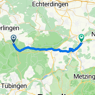
- Weil im Schönbuch, Baden-Wurttemberg, Germany
A cycling route starting in Weil im Schönbuch, Baden-Wurttemberg, Germany.
Overview
Beautiful Sunday tour
15.04.2018
created this 7 years ago


Route quality
Track
12.3 km
(65 %)
Road
4.5 km
(24 %)
Paved
15.2 km
(80 %)
Unpaved
2.3 km
(12 %)
Asphalt
14 km
(74 %)
Ground
1.9 km
(10 %)
Continue with Bikemap
You would like to ride Weil - Fernsehturm Waldenbuch - Weil or customize it for your own trip? Here is what you can do with this Bikemap route:
Free trial for 3 days, or one-time payment. More about Bikemap Premium.
Discover more Premium features.
Get Bikemap PremiumFrom our community
Open it in the app