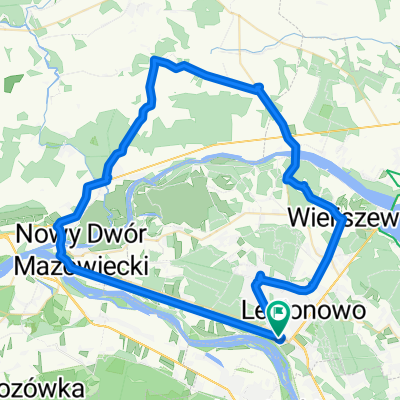
Pałac, konie i golf
A cycling route starting in Jabłonna, Masovian Voivodeship, Poland.
Overview
About this route
A light trip for the whole family - requiring no fitness. Clearing the path before more important outings :) Mazovian landscapes, a few elements from the Trail of Fighting Poland.
- -:--
- Duration
- 17.8 km
- Distance
- 34 m
- Ascent
- 37 m
- Descent
- ---
- Avg. speed
- ---
- Max. altitude
Route photos
Route quality
Waytypes & surfaces along the route
Waytypes
Path
6.9 km
(39 %)
Quiet road
4.8 km
(27 %)
Surfaces
Paved
3.4 km
(19 %)
Unpaved
11 km
(62 %)
Gravel
6.8 km
(38 %)
Ground
3.9 km
(22 %)
Route highlights
Points of interest along the route
Point of interest after 0.1 km
Urząd gminy
Point of interest after 0.5 km
Pałac w Jabłonnie
Point of interest after 4.1 km
Rezerwat Jabłonna
Point of interest after 7 km
sklep
Point of interest after 8.3 km
kościół pw. Andrzeja Boboli w Rajszewie
Point of interest after 8.9 km
Stajnia Na Kępie
Point of interest after 10.2 km
First Warsaw Golf
Point of interest after 16.2 km
Obszar Natura 2000
Point of interest after 17.7 km
pomnik AK
Continue with Bikemap
Use, edit, or download this cycling route
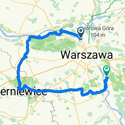
You would like to ride Pałac, konie i golf or customize it for your own trip? Here is what you can do with this Bikemap route:
Free features
- Save this route as favorite or in collections
- Copy & plan your own version of this route
- Sync your route with Garmin or Wahoo
Premium features
Free trial for 3 days, or one-time payment. More about Bikemap Premium.
- Navigate this route on iOS & Android
- Export a GPX / KML file of this route
- Create your custom printout (try it for free)
- Download this route for offline navigation
Discover more Premium features.
Get Bikemap PremiumFrom our community
Other popular routes starting in Jabłonna
- Pałac, konie i golf
- Distance
- 17.8 km
- Ascent
- 34 m
- Descent
- 37 m
- Location
- Jabłonna, Masovian Voivodeship, Poland
- 2014-ucieczka z W-wy na N/E
- Distance
- 72.1 km
- Ascent
- 66 m
- Descent
- 66 m
- Location
- Jabłonna, Masovian Voivodeship, Poland
- Kibiców, Warszawa do Światowida, Białołęka
- Distance
- 20.2 km
- Ascent
- 528 m
- Descent
- 525 m
- Location
- Jabłonna, Masovian Voivodeship, Poland
- tdw 200 moja
- Distance
- 208.1 km
- Ascent
- 207 m
- Descent
- 200 m
- Location
- Jabłonna, Masovian Voivodeship, Poland
- Warszawa-Toruń dzień 1
- Distance
- 120.3 km
- Ascent
- 170 m
- Descent
- 191 m
- Location
- Jabłonna, Masovian Voivodeship, Poland
- Trening
- Distance
- 67.5 km
- Ascent
- 100 m
- Descent
- 105 m
- Location
- Jabłonna, Masovian Voivodeship, Poland
- Trasa do HY?Õ?
- Distance
- 12.2 km
- Ascent
- 64 m
- Descent
- 63 m
- Location
- Jabłonna, Masovian Voivodeship, Poland
- Mistrzowskie Otwarcie Sezonu 2020 - Jabłonna
- Distance
- 119.9 km
- Ascent
- 333 m
- Descent
- 333 m
- Location
- Jabłonna, Masovian Voivodeship, Poland
Open it in the app