Goethetour 2017 -- 3.Etappe
- 123.6 km
- 907 m
- 909 m
- Altleiningen, Rhineland-Palatinate, Germany
A cycling route starting in Altleiningen, Rhineland-Palatinate, Germany.
Overview
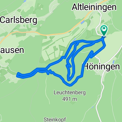
A tour of about 11 km that first follows the forest educational trail in Altleiningen, where there are 2 geocaches to complete (if you enjoy this type of treasure hunt). Afterwards, it continues along the mill path to Carlsberg and returns to Altleiningen over the heights.
created this 7 years ago
Route quality
Track
8.4 km
(74 %)
Path
2.7 km
(24 %)
Unpaved
9.9 km
(87 %)
Gravel
5.1 km
(45 %)
Ground
3 km
(26 %)
Continue with Bikemap
You would like to ride Waldlehrpfad Mühlenweg Altleiningen bis Carlsberg or customize it for your own trip? Here is what you can do with this Bikemap route:
Free trial for 3 days, or one-time payment. More about Bikemap Premium.
Discover more Premium features.
Get Bikemap PremiumFrom our community
Open it in the app