Plateau des Bornes 4 Col Loop + Salève
A cycling route starting in Neydens, Auvergne-RhĂ´ne-Alpes, France.
Overview
About this route
Col d'Evires, Le Pas de Cheval, Col Le Parc, Col de la Croisette
- -:--
- Duration
- 74.3 km
- Distance
- 1,326 m
- Ascent
- 1,325 m
- Descent
- ---
- Avg. speed
- ---
- Max. altitude
Route photos
Route quality
Waytypes & surfaces along the route
Waytypes
Road
40.1 km
(54 %)
Quiet road
20.8 km
(28 %)
Surfaces
Paved
29.7 km
(40 %)
Unpaved
0.7 km
(1 %)
Asphalt
29.7 km
(40 %)
Gravel
0.7 km
(1 %)
Undefined
43.8 km
(59 %)
Route highlights
Points of interest along the route
Point of interest after 41.3 km
Col d'Evires
Point of interest after 48.9 km
Le Pas de Cheval
Point of interest after 51.7 km
Col Le Parc
Point of interest after 65.1 km
Col de la Croisette
Continue with Bikemap
Use, edit, or download this cycling route
You would like to ride Plateau des Bornes 4 Col Loop + Salève or customize it for your own trip? Here is what you can do with this Bikemap route:
Free features
- Save this route as favorite or in collections
- Copy & plan your own version of this route
- Sync your route with Garmin or Wahoo
Premium features
Free trial for 3 days, or one-time payment. More about Bikemap Premium.
- Navigate this route on iOS & Android
- Export a GPX / KML file of this route
- Create your custom printout (try it for free)
- Download this route for offline navigation
Discover more Premium features.
Get Bikemap PremiumFrom our community
Other popular routes starting in Neydens
- Mont Saleve half
- Distance
- 19.1 km
- Ascent
- 466 m
- Descent
- 465 m
- Location
- Neydens, Auvergne-RhĂ´ne-Alpes, France
- Mont Saleve Huts
- Distance
- 15.9 km
- Ascent
- 320 m
- Descent
- 319 m
- Location
- Neydens, Auvergne-RhĂ´ne-Alpes, France
- Five Country Loop
- Distance
- 64.8 km
- Ascent
- 589 m
- Descent
- 589 m
- Location
- Neydens, Auvergne-RhĂ´ne-Alpes, France
- Circuit Neydens - Valleiry 48 km
- Distance
- 48.5 km
- Ascent
- 709 m
- Descent
- 709 m
- Location
- Neydens, Auvergne-RhĂ´ne-Alpes, France
- Stef@ns Tour zur Tour 2004 3. Etappe Teil 1 vom 18.07.04
- Distance
- 85.2 km
- Ascent
- 589 m
- Descent
- 875 m
- Location
- Neydens, Auvergne-RhĂ´ne-Alpes, France
- Le Saleve the steep way
- Distance
- 42.8 km
- Ascent
- 1,203 m
- Descent
- 1,134 m
- Location
- Neydens, Auvergne-RhĂ´ne-Alpes, France
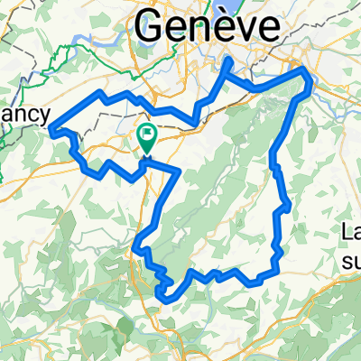
- Mont Salève Snow Trails
- Distance
- 40.7 km
- Ascent
- 932 m
- Descent
- 934 m
- Location
- Neydens, Auvergne-RhĂ´ne-Alpes, France
- Saleve via Col des Pitons
- Distance
- 35.6 km
- Ascent
- 979 m
- Descent
- 952 m
- Location
- Neydens, Auvergne-RhĂ´ne-Alpes, France
Open it in the app