
Rock around the "Sender" Langenberg
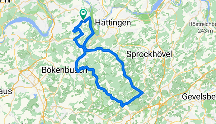
A cycling route starting in Hattingen, North Rhine-Westphalia, Germany.
Overview
About this route
Diese Runde zeichnet sich durch abwechselungsreiche Streckenführung in schöner landschaftlicher Umgebung aus.
Die Anstiege fallen zunächst moderat aus, ändern sich aber im weiteren Verlauf. Es gibt teilweise "knackige" Rampen, die auch schon mal Prozente von >= 15% aufweisen.
Die Beläge, speziell, die des Höhenweges sind teilweise sehr schlecht und erfordern eine umsichtige Fahrweise.
Die Strecke eignet sich grundsätzlich für alle Radtypen, unter Berücksichtigung der Topographie.
An Wochenenden ist man, speziell auf dem Höhenweg nicht alleine!!
PS: In der Nähe des Start- Zielpunktes in Niederwenigern befindet sich die Hausarztpraxis Irle/ Kramer mit eigenen Parkplätzen, die am Wochenende meist benutzbar sind.
- -:--
- Duration
- 38.7 km
- Distance
- 557 m
- Ascent
- 557 m
- Descent
- ---
- Avg. speed
- ---
- Max. altitude

Route quality
Waytypes & surfaces along the route
Waytypes
Quiet road
10.8 km
(28 %)
Road
7 km
(18 %)
Surfaces
Paved
37.1 km
(96 %)
Unpaved
0.4 km
(1 %)
Asphalt
37.1 km
(96 %)
Ground
0.4 km
(1 %)
Undefined
1.2 km
(3 %)
Continue with Bikemap
Use, edit, or download this cycling route
You would like to ride Rock around the "Sender" Langenberg or customize it for your own trip? Here is what you can do with this Bikemap route:
Free features
- Save this route as favorite or in collections
- Copy & plan your own version of this route
- Sync your route with Garmin or Wahoo
Premium features
Free trial for 3 days, or one-time payment. More about Bikemap Premium.
- Navigate this route on iOS & Android
- Export a GPX / KML file of this route
- Create your custom printout (try it for free)
- Download this route for offline navigation
Discover more Premium features.
Get Bikemap PremiumFrom our community
Other popular routes starting in Hattingen
 Rundweg Burgaltendorf - Langenberg
- Distance
- 26.7 km
- Ascent
- 515 m
- Descent
- 541 m
- Location
- Hattingen, North Rhine-Westphalia, Germany
 1xBaldeneysee und zurück
- Distance
- 54 km
- Ascent
- 219 m
- Descent
- 220 m
- Location
- Hattingen, North Rhine-Westphalia, Germany
 Bochum-Gemüsescheune Elfringhauserschweiz-Isenburg-Bochum
- Distance
- 23.8 km
- Ascent
- 326 m
- Descent
- 352 m
- Location
- Hattingen, North Rhine-Westphalia, Germany
 Eine Fahrt ins Muttental
- Distance
- 54.5 km
- Ascent
- 456 m
- Descent
- 457 m
- Location
- Hattingen, North Rhine-Westphalia, Germany
 Kemnade
- Distance
- 53.6 km
- Ascent
- 298 m
- Descent
- 298 m
- Location
- Hattingen, North Rhine-Westphalia, Germany
 Durch das Revier
- Distance
- 83.6 km
- Ascent
- 319 m
- Descent
- 317 m
- Location
- Hattingen, North Rhine-Westphalia, Germany
 Hattinger RTF 25km
- Distance
- 24.5 km
- Ascent
- 356 m
- Descent
- 354 m
- Location
- Hattingen, North Rhine-Westphalia, Germany
 Forstautobahn Surfer
- Distance
- 25.6 km
- Ascent
- 568 m
- Descent
- 570 m
- Location
- Hattingen, North Rhine-Westphalia, Germany
Open it in the app