- 24 km
- 377 m
- 383 m
- Ettal, Bavaria, Germany
Linderhof Ride
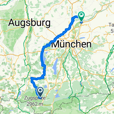
A cycling route starting in Ettal, Bavaria, Germany.
Overview
About this route
This is our Linderhof ride to the back gate of the castle. Recommend that you go early to avoid pedestrian walkers along forrest route and tourists at Linderhof.
- -:--
- Duration
- 24.2 km
- Distance
- 346 m
- Ascent
- 343 m
- Descent
- ---
- Avg. speed
- ---
- Max. altitude
created this 17 years ago
Route highlights
Points of interest along the route
Point of interest after 2.5 km
Here you make a left onto main highway, then take first right off highway. This will take you to the base of the mountain -- a nice varried terrrain.
Point of interest after 6.1 km
2 choices here: Stay on gravel road and enter Linderhof at the top back gate - or turn left and head to Linderhof via Grasswang on the highway (easier).
Point of interest after 10.2 km
Back gate entrance to Linderhof Castle!
Point of interest after 11.7 km
A great reason to do the back hill - this is some of the best applestrudel we have had! (at the restaurant, off tourist season).
Point of interest after 24.2 km
Great stopping place - nice sunny tables and beer!
Continue with Bikemap
Use, edit, or download this cycling route
You would like to ride Linderhof Ride or customize it for your own trip? Here is what you can do with this Bikemap route:
Free features
- Save this route as favorite or in collections
- Copy & plan your own version of this route
- Sync your route with Garmin or Wahoo
Premium features
Free trial for 3 days, or one-time payment. More about Bikemap Premium.
- Navigate this route on iOS & Android
- Export a GPX / KML file of this route
- Create your custom printout (try it for free)
- Download this route for offline navigation
Discover more Premium features.
Get Bikemap PremiumFrom our community
Other popular routes starting in Ettal
- Ettal- Unterammergau
- Ettal - Ersterbergalm
- 65 km
- 1,278 m
- 1,277 m
- Ettal, Bavaria, Germany
- Ueber den Baeckenalmsattel zur Kenzenhuette
- 59 km
- 1,005 m
- 1,004 m
- Ettal, Bavaria, Germany
- Ettal - Ehrwald
- 71.2 km
- 1,293 m
- 1,293 m
- Ettal, Bavaria, Germany
- GA-PA horní cesta Čtvrtek
- 53.9 km
- 706 m
- 735 m
- Ettal, Bavaria, Germany
- Ettal - Pähl
- 76.5 km
- 580 m
- 889 m
- Ettal, Bavaria, Germany
- Ammer-Amper-Radweg
- 190.7 km
- 1,181 m
- 1,582 m
- Ettal, Bavaria, Germany
- Linderhof Ride
- 24.2 km
- 346 m
- 343 m
- Ettal, Bavaria, Germany
Open it in the app


