Filipka i osada Zimny
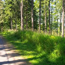
A cycling route starting in Cieszyn, Silesian Voivodeship, Poland.
Overview
About this route
Cz
- -:--
- Duration
- 61.9 km
- Distance
- 553 m
- Ascent
- 553 m
- Descent
- ---
- Avg. speed
- ---
- Avg. speed
Route quality
Waytypes & surfaces along the route
Waytypes
Quiet road
18 km
(29 %)
Road
11 km
(18 %)
Surfaces
Paved
31.6 km
(51 %)
Unpaved
4.1 km
(7 %)
Asphalt
27.1 km
(44 %)
Paved (undefined)
3.2 km
(5 %)
Continue with Bikemap
Use, edit, or download this cycling route
You would like to ride Filipka i osada Zimny or customize it for your own trip? Here is what you can do with this Bikemap route:
Free features
- Save this route as favorite or in collections
- Copy & plan your own version of this route
- Sync your route with Garmin or Wahoo
Premium features
Free trial for 3 days, or one-time payment. More about Bikemap Premium.
- Navigate this route on iOS & Android
- Export a GPX / KML file of this route
- Create your custom printout (try it for free)
- Download this route for offline navigation
Discover more Premium features.
Get Bikemap PremiumFrom our community
Other popular routes starting in Cieszyn
- Cieszyn-Dziegielow-Goleszow-Puncow-Cieszyn
- Distance
- 24.3 km
- Ascent
- 271 m
- Descent
- 276 m
- Location
- Cieszyn, Silesian Voivodeship, Poland
- GreenWays Cieszyn - Wiede艅 (Cracow - Vien)
- Distance
- 427.5 km
- Ascent
- 972 m
- Descent
- 1,104 m
- Location
- Cieszyn, Silesian Voivodeship, Poland
- Po pracy drog膮 okr臋偶n膮 :)
- Distance
- 80.9 km
- Ascent
- 725 m
- Descent
- 725 m
- Location
- Cieszyn, Silesian Voivodeship, Poland
- Retro Ostrawa
- Distance
- 100.2 km
- Ascent
- 353 m
- Descent
- 353 m
- Location
- Cieszyn, Silesian Voivodeship, Poland
- Cieszyn-Budzin-Tu艂-Cieszyn
- Distance
- 29 km
- Ascent
- 528 m
- Descent
- 528 m
- Location
- Cieszyn, Silesian Voivodeship, Poland
- -Vojkovice-Dobratice-Ligotka meralna-Smi艂owice-Trzyciez-Ropica Cieszyn
- Distance
- 67.5 km
- Ascent
- 460 m
- Descent
- 460 m
- Location
- Cieszyn, Silesian Voivodeship, Poland
- P. Nowy 艢wiat
- Distance
- 64.3 km
- Ascent
- 343 m
- Descent
- 343 m
- Location
- Cieszyn, Silesian Voivodeship, Poland
- Cieszyn-Tatry-Cieszyn
- Distance
- 371.9 km
- Ascent
- 2,669 m
- Descent
- 2,669 m
- Location
- Cieszyn, Silesian Voivodeship, Poland
Open it in the app