26.6.2010 Bad Münstereifel - Mayen
A cycling route starting in Bad Münstereifel, North Rhine-Westphalia, Germany.
Overview
About this route
fewer km, but 2 watersheds, then relaxation in the second half and amazing views all day long.
- -:--
- Duration
- 77.1 km
- Distance
- 787 m
- Ascent
- 803 m
- Descent
- ---
- Avg. speed
- ---
- Max. altitude
Route highlights
Points of interest along the route

Point of interest after 6.7 km
Waldkapelle Decke Tönnes

Point of interest after 8.8 km
Radioteleskop Effelsberg

Point of interest after 39 km
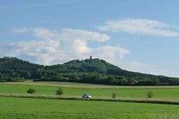
Nuerburg Castle

Point of interest after 45 km
Nürburgring - Nürburg

Point of interest after 50.5 km
Booser Doppelmaar

Point of interest after 60.2 km
Auf dem Weg nach St. Jost

Point of interest after 61.9 km
Wallfahrtskapelle St. Jost

Point of interest after 71.2 km
Schloss Bürresheim ...

Point of interest after 75.7 km
Genovevaburg,Mayen
Point of interest after 77 km
Marco und Guido Rosenberg |Ostbahnhofstr. 33 56727 Mayen
Continue with Bikemap
Use, edit, or download this cycling route
You would like to ride 26.6.2010 Bad Münstereifel - Mayen or customize it for your own trip? Here is what you can do with this Bikemap route:
Free features
- Save this route as favorite or in collections
- Copy & plan your own version of this route
- Sync your route with Garmin or Wahoo
Premium features
Free trial for 3 days, or one-time payment. More about Bikemap Premium.
- Navigate this route on iOS & Android
- Export a GPX / KML file of this route
- Create your custom printout (try it for free)
- Download this route for offline navigation
Discover more Premium features.
Get Bikemap PremiumFrom our community
Other popular routes starting in Bad Münstereifel
 Trails um Bad-Münstereifel
- Distance
- 42.2 km
- Ascent
- 579 m
- Descent
- 581 m
- Location
- Bad Münstereifel, North Rhine-Westphalia, Germany
 Bad Münstereifel-Gemünd-Bad Münstereifel
- Distance
- 59.1 km
- Ascent
- 538 m
- Descent
- 538 m
- Location
- Bad Münstereifel, North Rhine-Westphalia, Germany
 Antweiler - Nürburgring (Brünnchen)
- Distance
- 121.2 km
- Ascent
- 1,702 m
- Descent
- 1,700 m
- Location
- Bad Münstereifel, North Rhine-Westphalia, Germany
 Eifelrunde Ahr Hohe Acht
- Distance
- 120.1 km
- Ascent
- 1,869 m
- Descent
- 1,740 m
- Location
- Bad Münstereifel, North Rhine-Westphalia, Germany
 Große Rund um die Steinbachtalsperre
- Distance
- 33.1 km
- Ascent
- 375 m
- Descent
- 375 m
- Location
- Bad Münstereifel, North Rhine-Westphalia, Germany
 Bad Münstereifel-Steinbach-Rheinbach
- Distance
- 23 km
- Ascent
- 141 m
- Descent
- 251 m
- Location
- Bad Münstereifel, North Rhine-Westphalia, Germany
 Bad Münstereifel - Rundkurs - Offizielle Route 3
- Distance
- 34.5 km
- Ascent
- 713 m
- Descent
- 713 m
- Location
- Bad Münstereifel, North Rhine-Westphalia, Germany
 Feierabendtour
- Distance
- 15.5 km
- Ascent
- 261 m
- Descent
- 260 m
- Location
- Bad Münstereifel, North Rhine-Westphalia, Germany
Open it in the app


