1012_Veľký korytnický okruh
A cycling route starting in Banská Bystrica, Banská Bystrica Region, Slovakia.
Overview
About this route
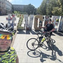
A challenging XC loop will provide you with great conditions for your training.
- -:--
- Duration
- 49.5 km
- Distance
- 1,099 m
- Ascent
- 1,101 m
- Descent
- ---
- Avg. speed
- ---
- Max. altitude
Route quality
Waytypes & surfaces along the route
Waytypes
Track
24.7 km
(50 %)
Path
12.9 km
(26 %)
Surfaces
Paved
3.5 km
(7 %)
Unpaved
26.7 km
(54 %)
Gravel
13.4 km
(27 %)
Ground
6.9 km
(14 %)
Continue with Bikemap
Use, edit, or download this cycling route
You would like to ride 1012_Veľký korytnický okruh or customize it for your own trip? Here is what you can do with this Bikemap route:
Free features
- Save this route as favorite or in collections
- Copy & plan your own version of this route
- Sync your route with Garmin or Wahoo
Premium features
Free trial for 3 days, or one-time payment. More about Bikemap Premium.
- Navigate this route on iOS & Android
- Export a GPX / KML file of this route
- Create your custom printout (try it for free)
- Download this route for offline navigation
Discover more Premium features.
Get Bikemap PremiumFrom our community
Other popular routes starting in Banská Bystrica
Selce do Špania Dolina- Distance
- 2.3 km
- Ascent
- 154 m
- Descent
- 69 m
- Location
- Banská Bystrica, Banská Bystrica Region, Slovakia
Tatranská 6 do Tatranská 86- Distance
- 13.3 km
- Ascent
- 553 m
- Descent
- 499 m
- Location
- Banská Bystrica, Banská Bystrica Region, Slovakia
Rovinka... Suchy vrch-Podlavice-Riecka-Riec. sedlo-Ravasky-Pod vysielacom-Hamor- Distance
- 18 km
- Ascent
- 504 m
- Descent
- 811 m
- Location
- Banská Bystrica, Banská Bystrica Region, Slovakia
Riecanske sedlo- Distance
- 10.4 km
- Ascent
- 432 m
- Descent
- 435 m
- Location
- Banská Bystrica, Banská Bystrica Region, Slovakia
Kráľová, Banská Bystrica až Zvolenská cesta, Banská Bystrica- Distance
- 49.1 km
- Ascent
- 212 m
- Descent
- 212 m
- Location
- Banská Bystrica, Banská Bystrica Region, Slovakia
1011_Výhľady pod Kozím- Distance
- 23 km
- Ascent
- 814 m
- Descent
- 816 m
- Location
- Banská Bystrica, Banská Bystrica Region, Slovakia
East tour of Banská Bystrica- Distance
- 36.2 km
- Ascent
- 396 m
- Descent
- 395 m
- Location
- Banská Bystrica, Banská Bystrica Region, Slovakia
Vlkanová - Malachov - Banská Bystrica- Distance
- 19 km
- Ascent
- 511 m
- Descent
- 446 m
- Location
- Banská Bystrica, Banská Bystrica Region, Slovakia
Open it in the app


