

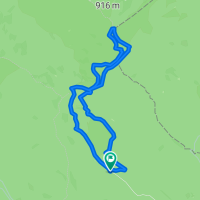
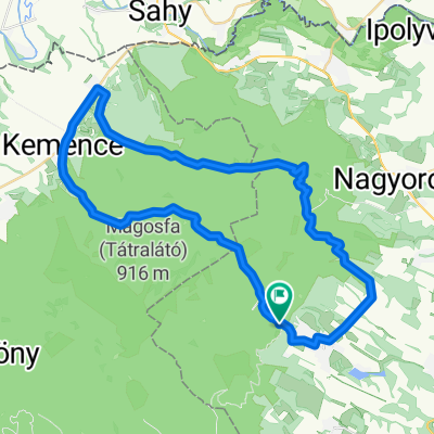
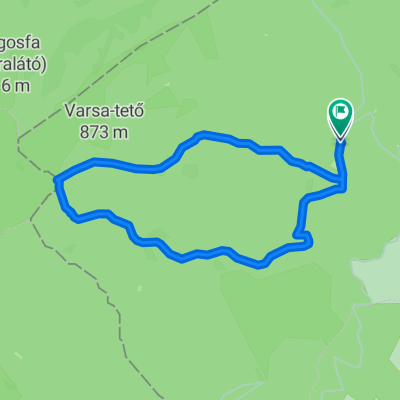
minden hegy :D, Börzsöny
A cycling route starting in Diósjenő, Nógrád megye, Hungary.
Overview
About this route
all mountains :D, Börzsöny
- -:--
- Duration
- 121.8 km
- Distance
- 2,551 m
- Ascent
- 2,578 m
- Descent
- ---
- Avg. speed
- ---
- Max. altitude

Route quality
Waytypes & surfaces along the route
Waytypes
Track
69.4 km
(57 %)
Path
32.9 km
(27 %)
Surfaces
Paved
14.6 km
(12 %)
Unpaved
86.5 km
(71 %)
Ground
68.2 km
(56 %)
Asphalt
14.6 km
(12 %)
Continue with Bikemap
Use, edit, or download this cycling route
You would like to ride minden hegy :D, Börzsöny or customize it for your own trip? Here is what you can do with this Bikemap route:
Free features
- Save this route as favorite or in collections
- Copy & plan your own version of this route
- Split it into stages to create a multi-day tour
- Sync your route with Garmin or Wahoo
Premium features
Free trial for 3 days, or one-time payment. More about Bikemap Premium.
- Navigate this route on iOS & Android
- Export a GPX / KML file of this route
- Create your custom printout (try it for free)
- Download this route for offline navigation
Discover more Premium features.
Get Bikemap PremiumFrom our community
Other popular routes starting in Diósjenő
 csovanyos
- Distance
- 15.6 km
- Ascent
- 630 m
- Descent
- 636 m
- Location
- Diósjenő, Nógrád megye, Hungary
![[Horizont] 14. Diósjenő - Nagymaros](https://media.bikemap.net/routes/17397580/staticmaps/in_b66b49b6-8422-4d04-a209-7a38f912b101_400x400_bikemap-2021-3D-static.png) [Horizont] 14. Diósjenő - Nagymaros
[Horizont] 14. Diósjenő - Nagymaros- Distance
- 47.2 km
- Ascent
- 574 m
- Descent
- 716 m
- Location
- Diósjenő, Nógrád megye, Hungary
 Királyháza 60
- Distance
- 59.5 km
- Ascent
- 755 m
- Descent
- 755 m
- Location
- Diósjenő, Nógrád megye, Hungary
 Route to Nógrád
- Distance
- 59 km
- Ascent
- 1,147 m
- Descent
- 1,144 m
- Location
- Diósjenő, Nógrád megye, Hungary
 Diósjenő - Kemence- Szob
- Distance
- 61.8 km
- Ascent
- 849 m
- Descent
- 970 m
- Location
- Diósjenő, Nógrád megye, Hungary
 Unnamed Road, Csóványos (938m) to Erdészet 1, Diósjenő
- Distance
- 6.3 km
- Ascent
- 7 m
- Descent
- 589 m
- Location
- Diósjenő, Nógrád megye, Hungary
 Diósjenő - Kemence - Bernecebaráti - Diósjenő
- Distance
- 44.6 km
- Ascent
- 521 m
- Descent
- 520 m
- Location
- Diósjenő, Nógrád megye, Hungary
 Börzsöny - Csóványos
- Distance
- 11.9 km
- Ascent
- 490 m
- Descent
- 489 m
- Location
- Diósjenő, Nógrád megye, Hungary
Open it in the app