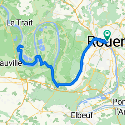
Balade Fête du vélo Nord
- 31.1 km
- 224 m
- 224 m
- Rouen, Normandy, France
A cycling route starting in Rouen, Normandy, France.
Overview
Via chemin de Clères until Quincampoix then back through the Robec valley or vice versa
created this 7 years ago
Route quality
Road
20.6 km
(66 %)
Quiet road
4.4 km
(14 %)
Paved
21.8 km
(70 %)
Unpaved
0.3 km
(1 %)
Asphalt
21.8 km
(70 %)
Gravel
0.3 km
(1 %)
Undefined
9 km
(29 %)
Continue with Bikemap
You would like to ride Balade Fête du vélo Nord or customize it for your own trip? Here is what you can do with this Bikemap route:
Free trial for 3 days, or one-time payment. More about Bikemap Premium.
Discover more Premium features.
Get Bikemap PremiumFrom our community
Open it in the app