

salle de sport
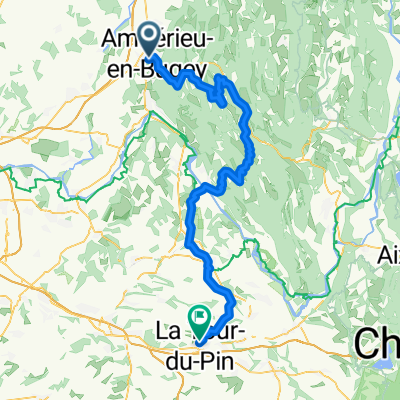
A cycling route starting in Ambérieu-en-Bugey, Auvergne-Rhône-Alpes, France.
Overview
About this route
- 20 min
- Duration
- 5.5 km
- Distance
- 8 m
- Ascent
- 16 m
- Descent
- 16.4 km/h
- Avg. speed
- ---
- Max. altitude

Route quality
Waytypes & surfaces along the route
Waytypes
Road
2.2 km
(40 %)
Cycleway
2 km
(36 %)
Surfaces
Paved
2.8 km
(52 %)
Asphalt
2.8 km
(52 %)
Undefined
2.6 km
(48 %)
Continue with Bikemap
Use, edit, or download this cycling route
You would like to ride salle de sport or customize it for your own trip? Here is what you can do with this Bikemap route:
Free features
- Save this route as favorite or in collections
- Copy & plan your own version of this route
- Sync your route with Garmin or Wahoo
Premium features
Free trial for 3 days, or one-time payment. More about Bikemap Premium.
- Navigate this route on iOS & Android
- Export a GPX / KML file of this route
- Create your custom printout (try it for free)
- Download this route for offline navigation
Discover more Premium features.
Get Bikemap PremiumFrom our community
Other popular routes starting in Ambérieu-en-Bugey
 Ambérieu - Culoz
- Distance
- 94.7 km
- Ascent
- 2,163 m
- Descent
- 2,171 m
- Location
- Ambérieu-en-Bugey, Auvergne-Rhône-Alpes, France
 Amberieu - La Tour du Pin
- Distance
- 91.3 km
- Ascent
- 1,280 m
- Descent
- 1,105 m
- Location
- Ambérieu-en-Bugey, Auvergne-Rhône-Alpes, France
 Ambérieu en Bugey, circuit 57 km
- Distance
- 57.2 km
- Ascent
- 1,162 m
- Descent
- 1,163 m
- Location
- Ambérieu-en-Bugey, Auvergne-Rhône-Alpes, France
 b8 Traversée du Bugey
- Distance
- 89.5 km
- Ascent
- 1,792 m
- Descent
- 1,759 m
- Location
- Ambérieu-en-Bugey, Auvergne-Rhône-Alpes, France
 Amberieu naar L' Isle-d'Abeau
- Distance
- 60 km
- Ascent
- 228 m
- Descent
- 275 m
- Location
- Ambérieu-en-Bugey, Auvergne-Rhône-Alpes, France
 acsp-cyt flèche vélocio 04 et 05 avril 2015
- Distance
- 390.1 km
- Ascent
- 2,391 m
- Descent
- 2,067 m
- Location
- Ambérieu-en-Bugey, Auvergne-Rhône-Alpes, France
 Ambérieu - Ambérieu
- Distance
- 115.3 km
- Ascent
- 2,046 m
- Descent
- 2,047 m
- Location
- Ambérieu-en-Bugey, Auvergne-Rhône-Alpes, France
 Lagnieu
- Distance
- 24.7 km
- Ascent
- 192 m
- Descent
- 143 m
- Location
- Ambérieu-en-Bugey, Auvergne-Rhône-Alpes, France
Open it in the app