

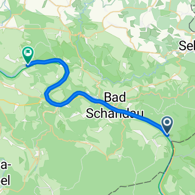
Wanderung Häntzschelstiege
A cycling route starting in Bad Schandau, Saxony, Germany.
Overview
About this route
- -:--
- Duration
- 13.3 km
- Distance
- 564 m
- Ascent
- 532 m
- Descent
- ---
- Avg. speed
- ---
- Max. altitude

Continue with Bikemap
Use, edit, or download this cycling route
You would like to ride Wanderung Häntzschelstiege or customize it for your own trip? Here is what you can do with this Bikemap route:
Free features
- Save this route as favorite or in collections
- Copy & plan your own version of this route
- Sync your route with Garmin or Wahoo
Premium features
Free trial for 3 days, or one-time payment. More about Bikemap Premium.
- Navigate this route on iOS & Android
- Export a GPX / KML file of this route
- Create your custom printout (try it for free)
- Download this route for offline navigation
Discover more Premium features.
Get Bikemap PremiumFrom our community
Other popular routes starting in Bad Schandau
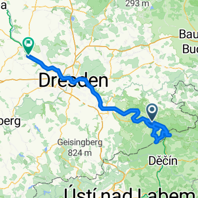
 Von Schmilka bis Stadt Wehlen
- Distance
- 22.3 km
- Ascent
- 10 m
- Descent
- 17 m
- Location
- Bad Schandau, Saxony, Germany
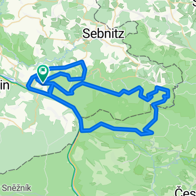
 B172 do An der Elbe
- Distance
- 13.6 km
- Ascent
- 48 m
- Descent
- 99 m
- Location
- Bad Schandau, Saxony, Germany
 2005 - Elberadweg Bad Schandau - Decin (CZ) - Leipzig
- Distance
- 304 km
- Ascent
- 797 m
- Descent
- 853 m
- Location
- Bad Schandau, Saxony, Germany
 Tetschen - Meißen
- Distance
- 123.9 km
- Ascent
- 1,632 m
- Descent
- 1,628 m
- Location
- Bad Schandau, Saxony, Germany
 Zum Kaltenberg
- Distance
- 84.1 km
- Ascent
- 850 m
- Descent
- 850 m
- Location
- Bad Schandau, Saxony, Germany
 Elbsandsteintour
- Distance
- 68.3 km
- Ascent
- 828 m
- Descent
- 828 m
- Location
- Bad Schandau, Saxony, Germany
 Elberadweg
- Distance
- 773.3 km
- Ascent
- 237 m
- Descent
- 394 m
- Location
- Bad Schandau, Saxony, Germany
 Elberadweg
- Distance
- 855.3 km
- Ascent
- 186 m
- Descent
- 327 m
- Location
- Bad Schandau, Saxony, Germany
Open it in the app