

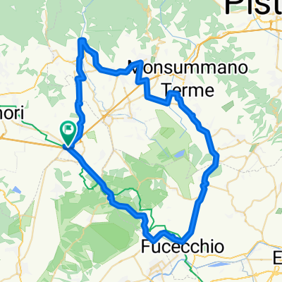
36 Via Fankigena Altopascio
A cycling route starting in Altopascio, Tuscany, Italy.
Overview
About this route
- -:--
- Duration
- 23.2 km
- Distance
- 160 m
- Ascent
- 145 m
- Descent
- ---
- Avg. speed
- ---
- Max. altitude
Route quality
Waytypes & surfaces along the route
Waytypes
Track
7.2 km
(31 %)
Quiet road
4.4 km
(19 %)
Surfaces
Paved
4.4 km
(19 %)
Unpaved
8.4 km
(36 %)
Asphalt
4.4 km
(19 %)
Ground
3.7 km
(16 %)
Continue with Bikemap
Use, edit, or download this cycling route
You would like to ride 36 Via Fankigena Altopascio or customize it for your own trip? Here is what you can do with this Bikemap route:
Free features
- Save this route as favorite or in collections
- Copy & plan your own version of this route
- Sync your route with Garmin or Wahoo
Premium features
Free trial for 3 days, or one-time payment. More about Bikemap Premium.
- Navigate this route on iOS & Android
- Export a GPX / KML file of this route
- Create your custom printout (try it for free)
- Download this route for offline navigation
Discover more Premium features.
Get Bikemap PremiumFrom our community
Other popular routes starting in Altopascio
 Altopascio S. Miniato
- Distance
- 30.8 km
- Ascent
- 297 m
- Descent
- 159 m
- Location
- Altopascio, Tuscany, Italy
 Itália 2013 - 6
- Distance
- 179.7 km
- Ascent
- 982 m
- Descent
- 982 m
- Location
- Altopascio, Tuscany, Italy
 Tuscan pasta shopping
- Distance
- 8.3 km
- Ascent
- 36 m
- Descent
- 33 m
- Location
- Altopascio, Tuscany, Italy
 Percorso verso Marginone
- Distance
- 11.6 km
- Ascent
- 29 m
- Descent
- 17 m
- Location
- Altopascio, Tuscany, Italy
 36 Via Fankigena Altopascio
- Distance
- 23.2 km
- Ascent
- 160 m
- Descent
- 145 m
- Location
- Altopascio, Tuscany, Italy
 Itália 2013 - 12
- Distance
- 66.1 km
- Ascent
- 263 m
- Descent
- 260 m
- Location
- Altopascio, Tuscany, Italy
 4 - Da Piazza Giuseppe Garibaldi 13, Altopascio a Piazza della Repubblica 8, San Miniato
- Distance
- 29 km
- Ascent
- 273 m
- Descent
- 143 m
- Location
- Altopascio, Tuscany, Italy
 Itália 2013 - 5
- Distance
- 213.8 km
- Ascent
- 1,139 m
- Descent
- 1,139 m
- Location
- Altopascio, Tuscany, Italy
Open it in the app