galibier + lautaret
- 100.7 km
- 2,791 m
- 2,789 m
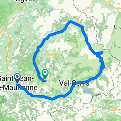
- Villargondran, Auvergne-Rhône-Alpes, France
A cycling route starting in Villargondran, Auvergne-Rhône-Alpes, France.
Overview
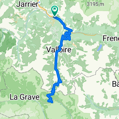
A less direct road to access Jarrier.
Car traffic is very low on this route. The passage through Saint Pancrace goes through a residential neighborhood...
created this 8 years ago
Route quality
Road
6.6 km
55 %
Quiet road
2.9 km
24 %
Undefined
2.5 km
21 %
Paved
11.5 km
(95 %)
Asphalt
8.3 km
69 %
Paved (undefined)
3.1 km
26 %
Undefined
0.6 km
5 %
Continue with Bikemap
You would like to ride Basique 3 or customize it for your own trip? Here is what you can do with this Bikemap route:
Free trial for 3 days, or one-time payment. More about Bikemap Premium.
Discover more Premium features.
Get Bikemap PremiumFrom our community
Open it in the app