

Sherburne Hall to Beaver Island Trail
A cycling route starting in Saint Cloud, Minnesota, United States.
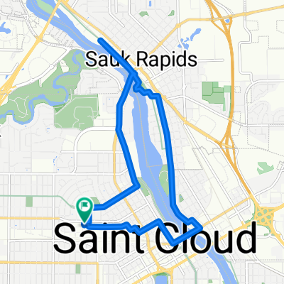
Overview
About this route
A route I rode from my dorm and back.
- 25 min
- Duration
- 4.8 km
- Distance
- 33 m
- Ascent
- 35 m
- Descent
- 11.4 km/h
- Avg. speed
- ---
- Max. altitude

Route photos


Route highlights
Points of interest along the route
Point of interest after 0.8 km
Steep climb!

Photo after 4.8 km
Picture of the dam
Continue with Bikemap
Use, edit, or download this cycling route
You would like to ride Sherburne Hall to Beaver Island Trail or customize it for your own trip? Here is what you can do with this Bikemap route:
Free features
- Save this route as favorite or in collections
- Copy & plan your own version of this route
- Sync your route with Garmin or Wahoo
Premium features
Free trial for 3 days, or one-time payment. More about Bikemap Premium.
- Navigate this route on iOS & Android
- Export a GPX / KML file of this route
- Create your custom printout (try it for free)
- Download this route for offline navigation
Discover more Premium features.
Get Bikemap PremiumFrom our community
Other popular routes starting in Saint Cloud
 Jail Trail
- Distance
- 7.4 km
- Ascent
- 45 m
- Descent
- 45 m
- Location
- Saint Cloud, Minnesota, United States
 round river 2 with lora
- Distance
- 7.8 km
- Ascent
- 57 m
- Descent
- 56 m
- Location
- Saint Cloud, Minnesota, United States
 Day 22 Lag 2
- Distance
- 123.7 km
- Ascent
- 115 m
- Descent
- 164 m
- Location
- Saint Cloud, Minnesota, United States
 Moderate route in Sauk Rapids
- Distance
- 8.3 km
- Ascent
- 124 m
- Descent
- 133 m
- Location
- Saint Cloud, Minnesota, United States
 2006 Veterans Dr, Saint Cloud to 1900 Veterans Dr, Saint Cloud
- Distance
- 18.3 km
- Ascent
- 79 m
- Descent
- 79 m
- Location
- Saint Cloud, Minnesota, United States
 1900 Veterans Dr, Saint Cloud to 1900 Veterans Dr, Saint Cloud
- Distance
- 15.8 km
- Ascent
- 703 m
- Descent
- 702 m
- Location
- Saint Cloud, Minnesota, United States
 1900 Veterans Dr, Saint Cloud to 1900 Veterans Dr, Saint Cloud
- Distance
- 12 km
- Ascent
- 61 m
- Descent
- 58 m
- Location
- Saint Cloud, Minnesota, United States
 Riverside
- Distance
- 8.4 km
- Ascent
- 31 m
- Descent
- 33 m
- Location
- Saint Cloud, Minnesota, United States
Open it in the app