

back on it
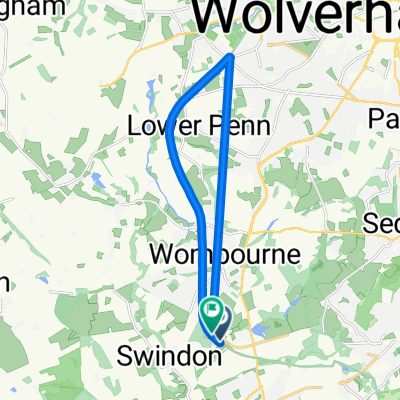
A cycling route starting in Kingswinford, England, United Kingdom.
Overview
About this route
- 33 min
- Duration
- 7.7 km
- Distance
- 35 m
- Ascent
- 65 m
- Descent
- 13.9 km/h
- Avg. speed
- ---
- Max. altitude

Continue with Bikemap
Use, edit, or download this cycling route
You would like to ride back on it or customize it for your own trip? Here is what you can do with this Bikemap route:
Free features
- Save this route as favorite or in collections
- Copy & plan your own version of this route
- Sync your route with Garmin or Wahoo
Premium features
Free trial for 3 days, or one-time payment. More about Bikemap Premium.
- Navigate this route on iOS & Android
- Export a GPX / KML file of this route
- Create your custom printout (try it for free)
- Download this route for offline navigation
Discover more Premium features.
Get Bikemap PremiumFrom our community
Other popular routes starting in Kingswinford
 Halfpenny Green Circular
- Distance
- 4.3 km
- Ascent
- 8 m
- Descent
- 10 m
- Location
- Kingswinford, England, United Kingdom
 Sytch Lane 24, Wombourne to Tettenhall Road 180
- Distance
- 10 km
- Ascent
- 35 m
- Descent
- 64 m
- Location
- Kingswinford, England, United Kingdom
 S Staffordshire Railway Walk, Himley, Dudley to S Staffordshire Railway Walk, Himley, Dudley
- Distance
- 14 km
- Ascent
- 59 m
- Descent
- 54 m
- Location
- Kingswinford, England, United Kingdom
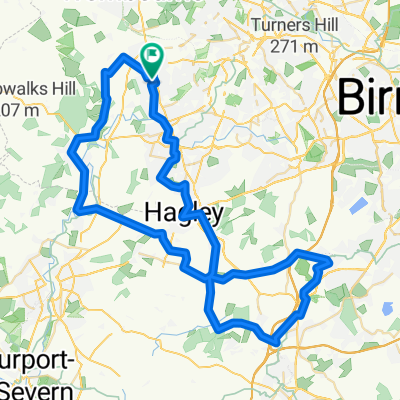
 Wall Heath - Lower Penn Loop
- Distance
- 22.6 km
- Ascent
- 209 m
- Descent
- 209 m
- Location
- Kingswinford, England, United Kingdom
 Pattingham/Wightwick
- Distance
- 49 km
- Ascent
- 245 m
- Descent
- 245 m
- Location
- Kingswinford, England, United Kingdom
 Catshill 40
- Distance
- 62.2 km
- Ascent
- 428 m
- Descent
- 428 m
- Location
- Kingswinford, England, United Kingdom
 Wordsley Loop via Caunsall and Kinver
- Distance
- 31.9 km
- Ascent
- 264 m
- Descent
- 265 m
- Location
- Kingswinford, England, United Kingdom
 Parents to Home
- Distance
- 116.6 km
- Ascent
- 212 m
- Descent
- 267 m
- Location
- Kingswinford, England, United Kingdom
Open it in the app