

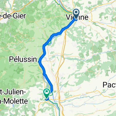
3- Villefranche-sur-Saône - Vienne
A cycling route starting in Vienne, Auvergne-Rhône-Alpes, France.
Overview
About this route
*** Left bank of the Saône (V50) up to Fontaine-sur-Saône:
-
unmarked towpath usually stabilized, sometimes dirt
-
greenway
*** Right bank of the Saône up to the Saint-Jean Cathedral in Lyon:
-
bike lanes
-
cycling paths
Streets in the Presqu'île
*** ViaRhôna up to Vienne
- -:--
- Duration
- 71.2 km
- Distance
- 140 m
- Ascent
- 270 m
- Descent
- ---
- Avg. speed
- ---
- Max. altitude

Route quality
Waytypes & surfaces along the route
Waytypes
Cycleway
17.8 km
(25 %)
Quiet road
14.2 km
(20 %)
Surfaces
Paved
47.7 km
(67 %)
Unpaved
7.8 km
(11 %)
Asphalt
41.3 km
(58 %)
Concrete
4.3 km
(6 %)
Continue with Bikemap
Use, edit, or download this cycling route
You would like to ride 3- Villefranche-sur-Saône - Vienne or customize it for your own trip? Here is what you can do with this Bikemap route:
Free features
- Save this route as favorite or in collections
- Copy & plan your own version of this route
- Sync your route with Garmin or Wahoo
Premium features
Free trial for 3 days, or one-time payment. More about Bikemap Premium.
- Navigate this route on iOS & Android
- Export a GPX / KML file of this route
- Create your custom printout (try it for free)
- Download this route for offline navigation
Discover more Premium features.
Get Bikemap PremiumFrom our community
Other popular routes starting in Vienne
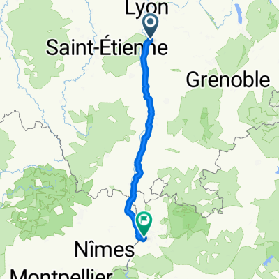
 Rhone-Vienne-south
- Distance
- 280.2 km
- Ascent
- 1,486 m
- Descent
- 1,568 m
- Location
- Vienne, Auvergne-Rhône-Alpes, France
 3- Villefranche-sur-Saône - Vienne
- Distance
- 71.2 km
- Ascent
- 140 m
- Descent
- 270 m
- Location
- Vienne, Auvergne-Rhône-Alpes, France
 Recovered Route
- Distance
- 4.3 km
- Ascent
- 114 m
- Descent
- 63 m
- Location
- Vienne, Auvergne-Rhône-Alpes, France
 Vienne - Serrières
- Distance
- 34 km
- Ascent
- 24 m
- Descent
- 41 m
- Location
- Vienne, Auvergne-Rhône-Alpes, France
 2012 French Tour -- Ride Day 9 -- 13 August 2012 -- Vienne (Lyon) to St Galmier
- Distance
- 73.2 km
- Ascent
- 1,103 m
- Descent
- 824 m
- Location
- Vienne, Auvergne-Rhône-Alpes, France
 Vienne - Valence par Hauterives
- Distance
- 98.5 km
- Ascent
- 829 m
- Descent
- 860 m
- Location
- Vienne, Auvergne-Rhône-Alpes, France
 14 Etap Tdf Vienne - Avignon
- Distance
- 206.1 km
- Ascent
- 409 m
- Descent
- 562 m
- Location
- Vienne, Auvergne-Rhône-Alpes, France
 vienne- valence
- Distance
- 87.8 km
- Ascent
- 135 m
- Descent
- 178 m
- Location
- Vienne, Auvergne-Rhône-Alpes, France
Open it in the app