
Pyrenees - Ride 2
A cycling route starting in Gerde, Languedoc-Roussillon-Midi-Pyrénées, France.
Overview
About this route
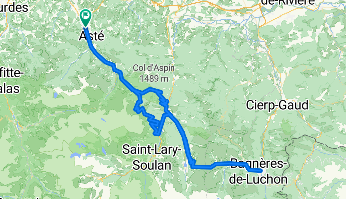
<span style="font-family: "Times New Roman","serif"; font-size: 12pt; mso-fareast-font-family: 'Lucida Sans Unicode'; mso-font-kerning: .5pt; mso-ansi-language: EN-GB; mso-fareast-language: #00FF; mso-bidi-language: AR-SA;"><span style="color: #000000;">Bagneres de Bigorre - <span style="font-family: "Times New Roman","serif"; font-size: 12pt; mso-fareast-font-family: 'Lucida Sans Unicode'; mso-font-kerning: .5pt; mso-ansi-language: EN-GB; mso-fareast-language: #00FF; mso-bidi-language: AR-SA;">Col d'Aspin<span style="mso-spacerun: yes;"> - <span style="font-family: "Times New Roman","serif"; font-size: 12pt; mso-fareast-font-family: 'Lucida Sans Unicode'; mso-font-kerning: .5pt; mso-ansi-language: EN-GB; mso-fareast-language: #00FF; mso-bidi-language: AR-SA;">Arreau - <span style="font-family: "Times New Roman","serif"; font-size: 12pt; mso-fareast-font-family: 'Lucida Sans Unicode'; mso-font-kerning: .5pt; mso-ansi-language: EN-GB; mso-fareast-language: #00FF; mso-bidi-language: AR-SA;">Col de Peyresourde - <span style="font-family: "Times New Roman","serif"; font-size: 12pt; mso-fareast-font-family: 'Lucida Sans Unicode'; mso-font-kerning: .5pt; mso-ansi-language: EN-GB; mso-fareast-language: #00FF; mso-bidi-language: AR-SA;">Bagneres de Luchon - <span style="font-family: "Times New Roman","serif"; font-size: 12pt; mso-fareast-font-family: 'Lucida Sans Unicode'; mso-font-kerning: .5pt; mso-ansi-language: EN-GB; mso-fareast-language: #00FF; mso-bidi-language: AR-SA;">Col de Peyresourde - <span style="font-family: "Times New Roman","serif"; font-size: 12pt; mso-fareast-font-family: 'Lucida Sans Unicode'; mso-font-kerning: .5pt; mso-ansi-language: EN-GB; mso-fareast-language: #00FF; mso-bidi-language: AR-SA;">Arreau - <span style="font-family: "Times New Roman","serif"; font-size: 12pt; mso-fareast-font-family: 'Lucida Sans Unicode'; mso-font-kerning: .5pt; mso-ansi-language: EN-GB; mso-fareast-language: #00FF; mso-bidi-language: AR-SA;">Guchen - <span style="font-family: "Times New Roman","serif"; font-size: 12pt; mso-fareast-font-family: 'Lucida Sans Unicode'; mso-font-kerning: .5pt; mso-ansi-language: EN-GB; mso-fareast-language: #00FF; mso-bidi-language: AR-SA;">Hourquette d'Ancizan - <span style="font-family: "Times New Roman","serif"; font-size: 12pt; mso-fareast-font-family: 'Lucida Sans Unicode'; mso-font-kerning: .5pt; mso-ansi-language: EN-GB; mso-fareast-language: #00FF; mso-bidi-language: AR-SA;">St Marie de Campan - <span style="font-family: "Times New Roman","serif"; font-size: 12pt; mso-fareast-font-family: 'Lucida Sans Unicode'; mso-font-kerning: .5pt; mso-ansi-language: EN-GB; mso-fareast-language: #00FF; mso-bidi-language: AR-SA;">Bagneres de Bigorre</span></span></span></span></span></span></span></span></span></span></span></span></span>
- -:--
- Duration
- 144.5 km
- Distance
- 3,312 m
- Ascent
- 3,312 m
- Descent
- ---
- Avg. speed
- ---
- Max. altitude

Continue with Bikemap
Use, edit, or download this cycling route
You would like to ride Pyrenees - Ride 2 or customize it for your own trip? Here is what you can do with this Bikemap route:
Free features
- Save this route as favorite or in collections
- Copy & plan your own version of this route
- Split it into stages to create a multi-day tour
- Sync your route with Garmin or Wahoo
Premium features
Free trial for 3 days, or one-time payment. More about Bikemap Premium.
- Navigate this route on iOS & Android
- Export a GPX / KML file of this route
- Create your custom printout (try it for free)
- Download this route for offline navigation
Discover more Premium features.
Get Bikemap PremiumFrom our community
Other popular routes starting in Gerde
 PY 13c, Bigorre - Bagnères-de-Luchon (Tourmalet, Hourquette, Peyresourde)
- Distance
- 107.2 km
- Ascent
- 3,051 m
- Descent
- 3,016 m
- Location
- Gerde, Languedoc-Roussillon-Midi-Pyrénées, France
 CCazun-22mai-départ montgaillard-94km-1820m D+
- Distance
- 81.9 km
- Ascent
- 1,361 m
- Descent
- 1,358 m
- Location
- Gerde, Languedoc-Roussillon-Midi-Pyrénées, France
 Tacx T15640 Tourmalet East
- Distance
- 26.5 km
- Ascent
- 1,547 m
- Descent
- 59 m
- Location
- Gerde, Languedoc-Roussillon-Midi-Pyrénées, France
 Day 3 (Hard) - Biarritz to Barca
- Distance
- 102.2 km
- Ascent
- 2,719 m
- Descent
- 2,323 m
- Location
- Gerde, Languedoc-Roussillon-Midi-Pyrénées, France
 Bagneres B - Aspin - Peyresourde - Aspin
- Distance
- 106.9 km
- Ascent
- 2,607 m
- Descent
- 2,593 m
- Location
- Gerde, Languedoc-Roussillon-Midi-Pyrénées, France
 15/07/2018
- Distance
- 80.7 km
- Ascent
- 2,123 m
- Descent
- 2,123 m
- Location
- Gerde, Languedoc-Roussillon-Midi-Pyrénées, France
 Montée du Géant
- Distance
- 97.4 km
- Ascent
- 2,965 m
- Descent
- 2,963 m
- Location
- Gerde, Languedoc-Roussillon-Midi-Pyrénées, France
 Dag II inkl Luz Ardiden
- Distance
- 150.5 km
- Ascent
- 4,499 m
- Descent
- 4,499 m
- Location
- Gerde, Languedoc-Roussillon-Midi-Pyrénées, France
Open it in the app