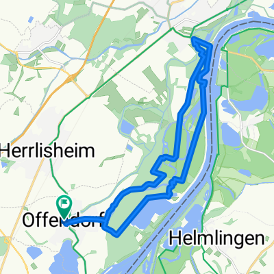
DURBACH
A cycling route starting in Herrlisheim, Grand Est, France.
Overview
About this route
- -:--
- Duration
- 81.5 km
- Distance
- 343 m
- Ascent
- 342 m
- Descent
- ---
- Avg. speed
- ---
- Max. altitude
Route quality
Waytypes & surfaces along the route
Waytypes
Road
45.3 km
(56 %)
Quiet road
17.5 km
(21 %)
Surfaces
Paved
61.5 km
(75 %)
Unpaved
1.7 km
(2 %)
Asphalt
55.9 km
(69 %)
Paved (undefined)
5.5 km
(7 %)
Continue with Bikemap
Use, edit, or download this cycling route
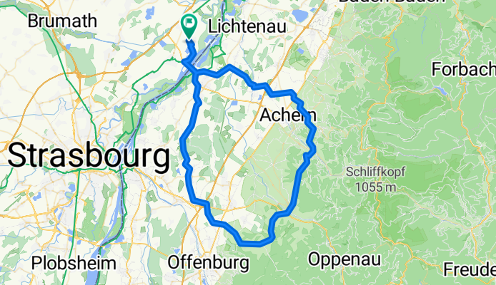
You would like to ride DURBACH or customize it for your own trip? Here is what you can do with this Bikemap route:
Free features
- Save this route as favorite or in collections
- Copy & plan your own version of this route
- Split it into stages to create a multi-day tour
- Sync your route with Garmin or Wahoo
Premium features
Free trial for 3 days, or one-time payment. More about Bikemap Premium.
- Navigate this route on iOS & Android
- Export a GPX / KML file of this route
- Create your custom printout (try it for free)
- Download this route for offline navigation
Discover more Premium features.
Get Bikemap PremiumFrom our community
Other popular routes starting in Herrlisheim
- Boucle autour du Rhin via le Bac
- Distance
- 39.2 km
- Ascent
- 174 m
- Descent
- 172 m
- Location
- Herrlisheim, Grand Est, France
- Rue de la Haute-Vienne, Herrlisheim nach Rue de la Gravière, Gambsheim
- Distance
- 7.1 km
- Ascent
- 10 m
- Descent
- 13 m
- Location
- Herrlisheim, Grand Est, France
- Rue du Cimetière nach Rue de Drusenheim
- Distance
- 2.6 km
- Ascent
- 9 m
- Descent
- 61 m
- Location
- Herrlisheim, Grand Est, France
- 05 Herrlisheim - Lingenfeld
- Distance
- 92.2 km
- Ascent
- 193 m
- Descent
- 208 m
- Location
- Herrlisheim, Grand Est, France
- offendorf
- Distance
- 3.2 km
- Ascent
- 0 m
- Descent
- 0 m
- Location
- Herrlisheim, Grand Est, France
- Rue du Cimetière nach Rue de Drusenheim
- Distance
- 2.5 km
- Ascent
- 3 m
- Descent
- 3 m
- Location
- Herrlisheim, Grand Est, France
- 1
- Distance
- 11.7 km
- Ascent
- 8 m
- Descent
- 4 m
- Location
- Herrlisheim, Grand Est, France
- offendorf 2
- Distance
- 17.4 km
- Ascent
- 43 m
- Descent
- 42 m
- Location
- Herrlisheim, Grand Est, France
Open it in the app