

Deutschlandtour 2018
02. Walkenried - Witzenhausen
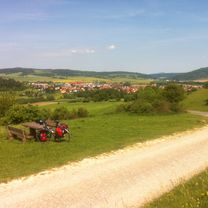
A cycling route starting in Walkenried, Lower Saxony, Germany.
Overview
About this route
- -:--
- Duration
- 78.4 km
- Distance
- 632 m
- Ascent
- 761 m
- Descent
- ---
- Avg. speed
- ---
- Max. altitude

Part of
Deutschlandtour 2018
12 stages
Route quality
Waytypes & surfaces along the route
Waytypes
Track
18.8 km
(24 %)
Road
14.1 km
(18 %)
Surfaces
Paved
54.1 km
(69 %)
Unpaved
3.9 km
(5 %)
Asphalt
48.6 km
(62 %)
Concrete
4.7 km
(6 %)
Continue with Bikemap
Use, edit, or download this cycling route
You would like to ride 02. Walkenried - Witzenhausen or customize it for your own trip? Here is what you can do with this Bikemap route:
Free features
- Save this route as favorite or in collections
- Copy & plan your own version of this route
- Sync your route with Garmin or Wahoo
Premium features
Free trial for 3 days, or one-time payment. More about Bikemap Premium.
- Navigate this route on iOS & Android
- Export a GPX / KML file of this route
- Create your custom printout (try it for free)
- Download this route for offline navigation
Discover more Premium features.
Get Bikemap PremiumFrom our community
Other popular routes starting in Walkenried
 Tag 2, Walkenried- BadSooden-Allendorf, 100km
- Distance
- 100.5 km
- Ascent
- 958 m
- Descent
- 1,062 m
- Location
- Walkenried, Lower Saxony, Germany
 Alp De Huez des Harzes
- Distance
- 79.9 km
- Ascent
- 1,143 m
- Descent
- 1,139 m
- Location
- Walkenried, Lower Saxony, Germany
 HT 031: Siebertal + Südharzeisenbahn
- Distance
- 59.7 km
- Ascent
- 694 m
- Descent
- 802 m
- Location
- Walkenried, Lower Saxony, Germany
 6.Step Tour Eiserner Vorhang
- Distance
- 34.7 km
- Ascent
- 339 m
- Descent
- 424 m
- Location
- Walkenried, Lower Saxony, Germany
 Bad Sachsa Radfahren
- Distance
- 20.7 km
- Ascent
- 626 m
- Descent
- 335 m
- Location
- Walkenried, Lower Saxony, Germany
 Harzradrundweg
- Distance
- 298.4 km
- Ascent
- 1,298 m
- Descent
- 1,294 m
- Location
- Walkenried, Lower Saxony, Germany
 02. Walkenried - Witzenhausen
- Distance
- 78.4 km
- Ascent
- 632 m
- Descent
- 761 m
- Location
- Walkenried, Lower Saxony, Germany
 Walkenried-Friedland
- Distance
- 69.7 km
- Ascent
- 443 m
- Descent
- 529 m
- Location
- Walkenried, Lower Saxony, Germany
Open it in the app