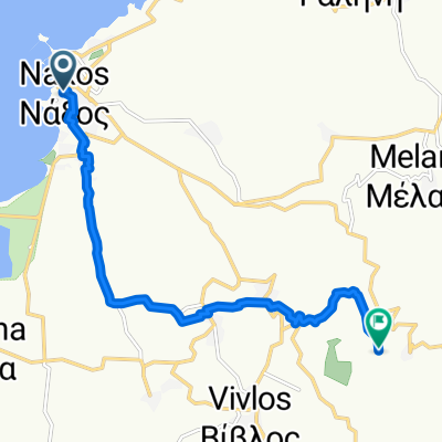
Naxos Nord
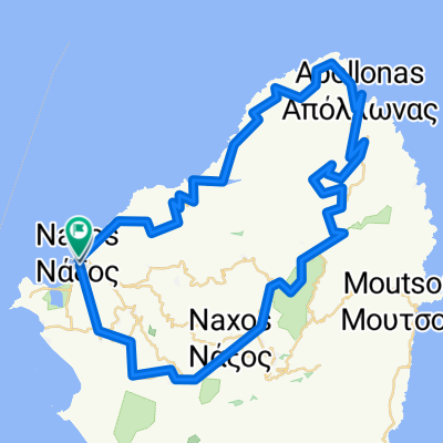
A cycling route starting in Naxos, South Aegean, Greece.
Overview
About this route
- -:--
- Duration
- 69.3 km
- Distance
- 1,142 m
- Ascent
- 1,143 m
- Descent
- ---
- Avg. speed
- ---
- Avg. speed
Route quality
Waytypes & surfaces along the route
Waytypes
Busy road
45.5 km
(66 %)
Quiet road
15 km
(22 %)
Surfaces
Paved
48.4 km
(70 %)
Unpaved
4.4 km
(6 %)
Asphalt
47.4 km
(68 %)
Ground
4.2 km
(6 %)
Continue with Bikemap
Use, edit, or download this cycling route
You would like to ride Naxos Nord or customize it for your own trip? Here is what you can do with this Bikemap route:
Free features
- Save this route as favorite or in collections
- Copy & plan your own version of this route
- Sync your route with Garmin or Wahoo
Premium features
Free trial for 3 days, or one-time payment. More about Bikemap Premium.
- Navigate this route on iOS & Android
- Export a GPX / KML file of this route
- Create your custom printout (try it for free)
- Download this route for offline navigation
Discover more Premium features.
Get Bikemap PremiumFrom our community
Other popular routes starting in Naxos
- Naxos Nord
- Distance
- 69.3 km
- Ascent
- 1,142 m
- Descent
- 1,143 m
- Location
- Naxos, South Aegean, Greece
- view of interior
- Distance
- 18.3 km
- Ascent
- 275 m
- Descent
- 284 m
- Location
- Naxos, South Aegean, Greece
- Naxos day 2
- Distance
- 59.7 km
- Ascent
- 613 m
- Descent
- 613 m
- Location
- Naxos, South Aegean, Greece
- Bike to Mikri Vigla
- Distance
- 15.4 km
- Ascent
- 88 m
- Descent
- 64 m
- Location
- Naxos, South Aegean, Greece
- Beachtour (Athina)
- Distance
- 40 km
- Ascent
- 198 m
- Descent
- 205 m
- Location
- Naxos, South Aegean, Greece
- naxos round
- Distance
- 58 km
- Ascent
- 868 m
- Descent
- 854 m
- Location
- Naxos, South Aegean, Greece
- Naxos_2_82
- Distance
- 83 km
- Ascent
- 1,153 m
- Descent
- 1,153 m
- Location
- Naxos, South Aegean, Greece
- CYC Naxos Haven-Agia Anna
- Distance
- 8.4 km
- Ascent
- 47 m
- Descent
- 46 m
- Location
- Naxos, South Aegean, Greece