

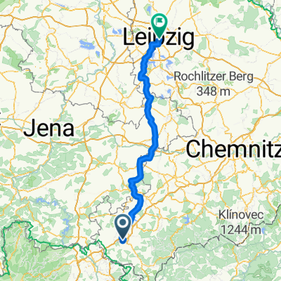
Elsterradweg mit Points
A cycling route starting in Bösenbrunn, Saxony, Germany.
Overview
About this route
- -:--
- Duration
- 207.4 km
- Distance
- 347 m
- Ascent
- 703 m
- Descent
- ---
- Avg. speed
- ---
- Max. altitude

Route quality
Waytypes & surfaces along the route
Waytypes
Path
54.6 km
(26 %)
Road
48.4 km
(23 %)
Surfaces
Paved
159.6 km
(77 %)
Unpaved
26.4 km
(13 %)
Asphalt
147.8 km
(71 %)
Ground
10.6 km
(5 %)
Route highlights
Points of interest along the route
Point of interest after 42 km
LGH Petzold
Point of interest after 137.5 km
Gasthof zur Eiche
Continue with Bikemap
Use, edit, or download this cycling route
You would like to ride Elsterradweg mit Points or customize it for your own trip? Here is what you can do with this Bikemap route:
Free features
- Save this route as favorite or in collections
- Copy & plan your own version of this route
- Split it into stages to create a multi-day tour
- Sync your route with Garmin or Wahoo
Premium features
Free trial for 3 days, or one-time payment. More about Bikemap Premium.
- Navigate this route on iOS & Android
- Export a GPX / KML file of this route
- Create your custom printout (try it for free)
- Download this route for offline navigation
Discover more Premium features.
Get Bikemap PremiumFrom our community
Other popular routes starting in Bösenbrunn
 Arbeitsweg
- Distance
- 32 km
- Ascent
- 307 m
- Descent
- 309 m
- Location
- Bösenbrunn, Saxony, Germany
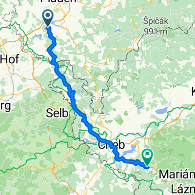
 Taltitz - Leipzig 138 km
- Distance
- 137.7 km
- Ascent
- 398 m
- Descent
- 668 m
- Location
- Bösenbrunn, Saxony, Germany
 Elsterradweg mit Points
- Distance
- 207.4 km
- Ascent
- 347 m
- Descent
- 703 m
- Location
- Bösenbrunn, Saxony, Germany
 Eurobiketour - Dag 7
- Distance
- 75.1 km
- Ascent
- 842 m
- Descent
- 720 m
- Location
- Bösenbrunn, Saxony, Germany
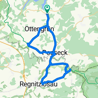 Grenzland
- Distance
- 27.7 km
- Ascent
- 383 m
- Descent
- 367 m
- Location
- Bösenbrunn, Saxony, Germany
 Taltitz - Leipzig 151 km
- Distance
- 150.6 km
- Ascent
- 548 m
- Descent
- 817 m
- Location
- Bösenbrunn, Saxony, Germany
 Drödaer Straße 10, Bösenbrunn nach Drödaer Straße 11, Bösenbrunn
- Distance
- 36.9 km
- Ascent
- 662 m
- Descent
- 664 m
- Location
- Bösenbrunn, Saxony, Germany
 Talsperre_Pirk_Plauen_Lochbauer_Plauen
- Distance
- 26.5 km
- Ascent
- 363 m
- Descent
- 347 m
- Location
- Bösenbrunn, Saxony, Germany
Open it in the app