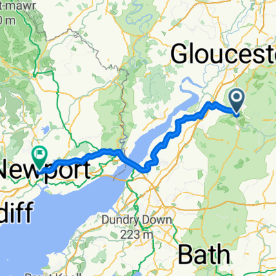
Day 2 2018
A cycling route starting in Stroud, England, United Kingdom.
Overview
About this route
- -:--
- Duration
- 70.6 km
- Distance
- 445 m
- Ascent
- 354 m
- Descent
- ---
- Avg. speed
- ---
- Avg. speed
Route quality
Waytypes & surfaces along the route
Waytypes
Road
32.6 km
(46 %)
Quiet road
25.9 km
(37 %)
Surfaces
Paved
14.9 km
(21 %)
Unpaved
3.1 km
(4 %)
Asphalt
14.8 km
(21 %)
Ground
2.7 km
(4 %)
Continue with Bikemap
Use, edit, or download this cycling route
You would like to ride Day 2 2018 or customize it for your own trip? Here is what you can do with this Bikemap route:
Free features
- Save this route as favorite or in collections
- Copy & plan your own version of this route
- Sync your route with Garmin or Wahoo
Premium features
Free trial for 3 days, or one-time payment. More about Bikemap Premium.
- Navigate this route on iOS & Android
- Export a GPX / KML file of this route
- Create your custom printout (try it for free)
- Download this route for offline navigation
Discover more Premium features.
Get Bikemap PremiumFrom our community
Other popular routes starting in Stroud
- day 3 2018
- Distance
- 73.7 km
- Ascent
- 183 m
- Descent
- 177 m
- Location
- Stroud, England, United Kingdom
- A testing 20 mile circuit Whiteshill to Stroud, Bisley, The Camp, Birdlip, Painswick Beacon, Edge & back
- Distance
- 31.3 km
- Ascent
- 409 m
- Descent
- 403 m
- Location
- Stroud, England, United Kingdom
- Whiteshill to Nailsworth, Avening, Cherrington, Sapperton, Duntisbourne Abbotts, Winstone, Syde, Brimpsfield, Birdlip, Bulls Cross & home
- Distance
- 55.5 km
- Ascent
- 496 m
- Descent
- 499 m
- Location
- Stroud, England, United Kingdom
- Whiteshill to Gloucester via Stonehouse, Standish, Epney, canal path to docks & cathedral, Hardwicke Stonehouse, Ruscombe & return
- Distance
- 57.9 km
- Ascent
- 288 m
- Descent
- 332 m
- Location
- Stroud, England, United Kingdom
- Day 2 2018
- Distance
- 70.6 km
- Ascent
- 445 m
- Descent
- 354 m
- Location
- Stroud, England, United Kingdom
- Albert to Nailsworth - 8 miles
- Distance
- 13.5 km
- Ascent
- 195 m
- Descent
- 194 m
- Location
- Stroud, England, United Kingdom
- 40+ mile loop of Stroud via Slad, Sapperton, Cherrington, Chavenage, Kingscote, Owlpen, Uley, Coaley, Frocester, The Stanleys, Selsley & return
- Distance
- 68.2 km
- Ascent
- 668 m
- Descent
- 673 m
- Location
- Stroud, England, United Kingdom
- Option 2 Whiteshill to Arlingham
- Distance
- 52.8 km
- Ascent
- 225 m
- Descent
- 220 m
- Location
- Stroud, England, United Kingdom