
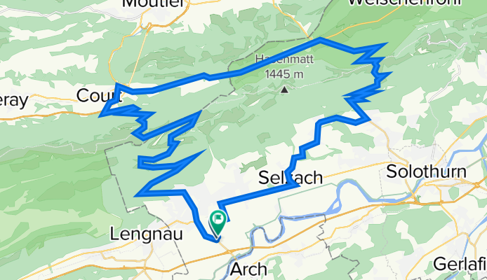
Grenchen - Grenchenberg - Binzberg - Weissenstein - Grenchen
A cycling route starting in Grenchen, Canton of Solothurn, Switzerland.
Overview
About this route
Obsi - nidsi - obsi - nidsi - obsi - nidsi - flach hei
- -:--
- Duration
- 58.1 km
- Distance
- 1,776 m
- Ascent
- 1,777 m
- Descent
- ---
- Avg. speed
- ---
- Max. altitude
Route quality
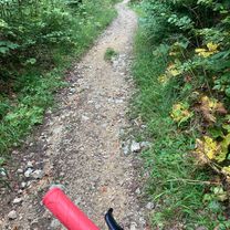
Waytypes & surfaces along the route
Waytypes
Road
28.2 km
(49 %)
Quiet road
17.5 km
(30 %)
Surfaces
Paved
36.3 km
(63 %)
Unpaved
1.7 km
(3 %)
Asphalt
36.2 km
(62 %)
Gravel
1.1 km
(2 %)
Continue with Bikemap
Use, edit, or download this cycling route
You would like to ride Grenchen - Grenchenberg - Binzberg - Weissenstein - Grenchen or customize it for your own trip? Here is what you can do with this Bikemap route:
Free features
- Save this route as favorite or in collections
- Copy & plan your own version of this route
- Sync your route with Garmin or Wahoo
Premium features
Free trial for 3 days, or one-time payment. More about Bikemap Premium.
- Navigate this route on iOS & Android
- Export a GPX / KML file of this route
- Create your custom printout (try it for free)
- Download this route for offline navigation
Discover more Premium features.
Get Bikemap PremiumFrom our community
Other popular routes starting in Grenchen
 Rebgässli 20, Grenchen nach Seestrandweg 101, Erlach
- Distance
- 36 km
- Ascent
- 268 m
- Descent
- 376 m
- Location
- Grenchen, Canton of Solothurn, Switzerland
 Stredná trasa Grenchen
- Distance
- 19.1 km
- Ascent
- 243 m
- Descent
- 336 m
- Location
- Grenchen, Canton of Solothurn, Switzerland
 Grenchen-Sonceboz, 01.09.2018
- Distance
- 31.2 km
- Ascent
- 972 m
- Descent
- 921 m
- Location
- Grenchen, Canton of Solothurn, Switzerland
 LA CHASSERALE 1
- Distance
- 40.8 km
- Ascent
- 1,203 m
- Descent
- 917 m
- Location
- Grenchen, Canton of Solothurn, Switzerland
 Grenchen - Oensingen
- Distance
- 71.4 km
- Ascent
- 999 m
- Descent
- 999 m
- Location
- Grenchen, Canton of Solothurn, Switzerland
 Grenchenberg Mountainbike
- Distance
- 16.2 km
- Ascent
- 475 m
- Descent
- 441 m
- Location
- Grenchen, Canton of Solothurn, Switzerland
 Bergstrasse, Grenchen nach Dahlienweg 5, Arch
- Distance
- 15.3 km
- Ascent
- 199 m
- Descent
- 899 m
- Location
- Grenchen, Canton of Solothurn, Switzerland
 Flughafenstrasse 123, Grenchen nach Dahlienweg 4, Arch
- Distance
- 82 km
- Ascent
- 1,519 m
- Descent
- 1,472 m
- Location
- Grenchen, Canton of Solothurn, Switzerland
Open it in the app