Passa pais
A cycling route starting in Saint-Amans-Soult, Occitanie, France.
Overview
About this route
Green Way Connecting Mazamet to BéDARIEUX
- -:--
- Duration
- 87.3 km
- Distance
- 381 m
- Ascent
- 462 m
- Descent
- ---
- Avg. speed
- ---
- Max. altitude
Route quality
Waytypes & surfaces along the route
Waytypes
Path
70.7 km
(81 %)
Access road
5.2 km
(6 %)
Surfaces
Paved
22.7 km
(26 %)
Unpaved
60.2 km
(69 %)
Gravel
60.2 km
(69 %)
Asphalt
21.8 km
(25 %)
Continue with Bikemap
Use, edit, or download this cycling route
You would like to ride Passa pais or customize it for your own trip? Here is what you can do with this Bikemap route:
Free features
- Save this route as favorite or in collections
- Copy & plan your own version of this route
- Split it into stages to create a multi-day tour
- Sync your route with Garmin or Wahoo
Premium features
Free trial for 3 days, or one-time payment. More about Bikemap Premium.
- Navigate this route on iOS & Android
- Export a GPX / KML file of this route
- Create your custom printout (try it for free)
- Download this route for offline navigation
Discover more Premium features.
Get Bikemap PremiumFrom our community
Other popular routes starting in Saint-Amans-Soult
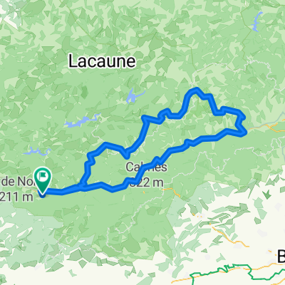
Pradelles-Cabardès - Saint-Pons-de-Thomières- Distance
- 59 km
- Ascent
- 757 m
- Descent
- 1,260 m
- Location
- Saint-Amans-Soult, Occitanie, France
Pic de Nore - Villegly- Distance
- 30.8 km
- Ascent
- 473 m
- Descent
- 1,406 m
- Location
- Saint-Amans-Soult, Occitanie, France
Passa pais- Distance
- 87.3 km
- Ascent
- 381 m
- Descent
- 462 m
- Location
- Saint-Amans-Soult, Occitanie, France
De Route Forestière des Douzes, Castans à Route Forestière des Douzes, Castans- Distance
- 21.1 km
- Ascent
- 591 m
- Descent
- 738 m
- Location
- Saint-Amans-Soult, Occitanie, France
triby peyremaux bt pont- Distance
- 38.2 km
- Ascent
- 408 m
- Descent
- 1,109 m
- Location
- Saint-Amans-Soult, Occitanie, France
Route Albine 3- Distance
- 124.3 km
- Ascent
- 1,246 m
- Descent
- 1,245 m
- Location
- Saint-Amans-Soult, Occitanie, France
20160908_085636.gpx- Distance
- 58.8 km
- Ascent
- 621 m
- Descent
- 922 m
- Location
- Saint-Amans-Soult, Occitanie, France
PYG-Pyrenees Day 20- Distance
- 106.3 km
- Ascent
- 446 m
- Descent
- 1,346 m
- Location
- Saint-Amans-Soult, Occitanie, France
Open it in the app


