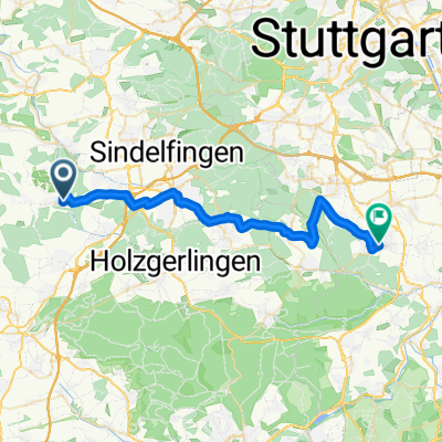
von Aidlingen nach Renningen
- 30.1 km
- 320 m
- 383 m
- Aidlingen, Baden-Wurttemberg, Germany
A cycling route starting in Aidlingen, Baden-Wurttemberg, Germany.
Overview
Start and finish is the playground on Schafhauser Straße in Aidlingen.
From there, it heads towards Dagersheim. Shortly after leaving Aidlingen, there's a short but steep climb. Once that's done, the rest of the route is much easier.
At the Dagersheim sports field, we turn into Egelseeweg and ride through the forest. The path is gravelled or covered with small gravel, making it relatively pleasant to ride, even with a city bike. All other paths are paved.
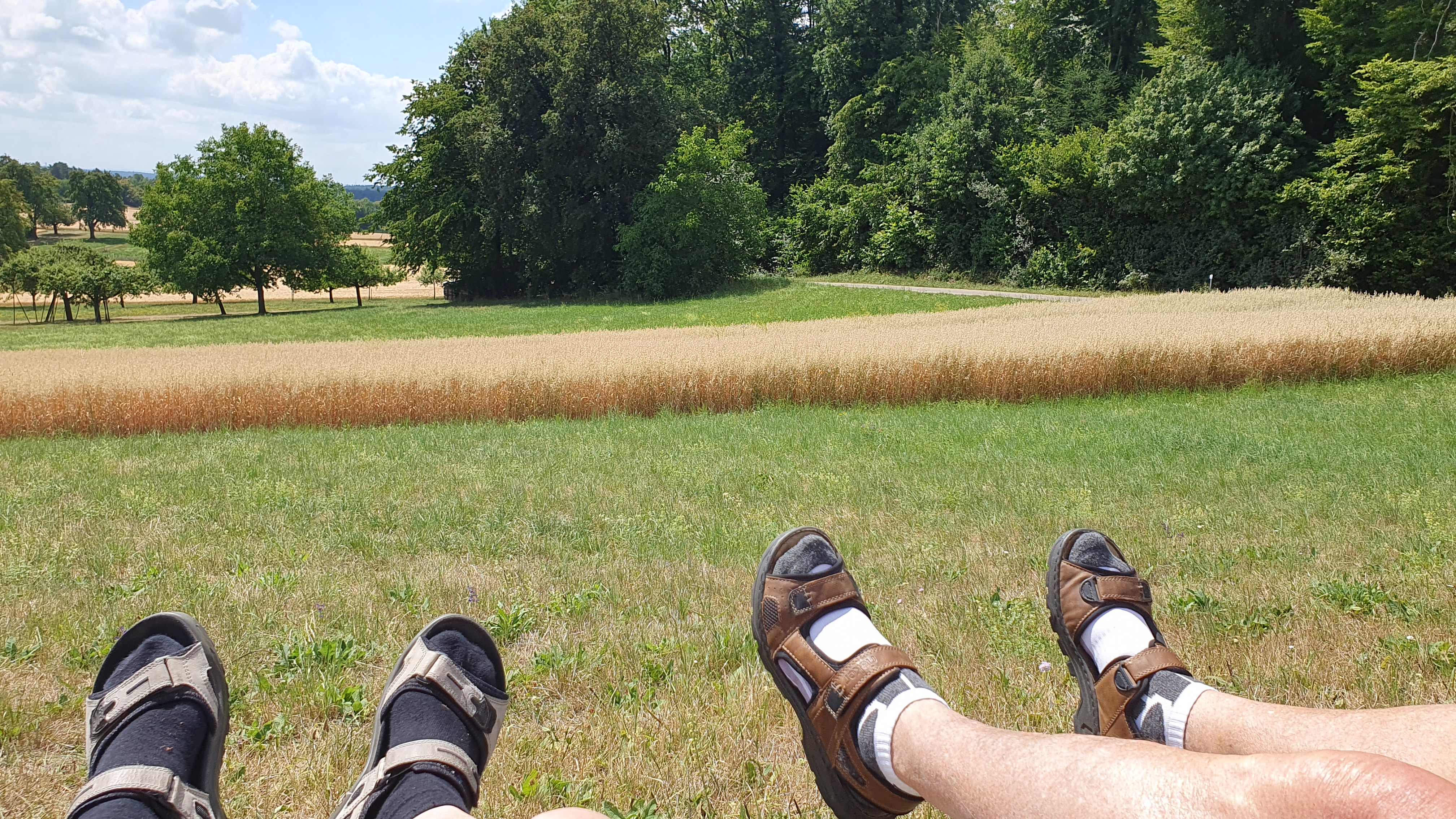
After a short distance, we come to a clearing with a beautiful, colorful meadow. While taking a short break here and sitting on a bench, we even saw a deer cross the path and disappear into the woods.
We continue back into the forest, passing a small lake towards Ehningen.
The ride goes along the southern edge of Ehningen to Gärtringen. Then we head into the Waldhöfe. We pass the Landgasthaus Heahrhäusle (where you can indulge in delicious regional dishes) and arrive at a farm where you can stock up on fresh milk and eggs, and also refresh yourself with milkshakes of all kinds.
Then we head back to Aidlingen, through the town center and over Sonnenberg to the starting point at the playground on Schafhauser Straße.
created this 7 years ago
Route quality
Track
11.5 km
(47 %)
Quiet road
6.6 km
(27 %)
Paved
22.3 km
(91 %)
Unpaved
2.2 km
(9 %)
Asphalt
22.3 km
(91 %)
Loose gravel
2.2 km
(9 %)
Continue with Bikemap
You would like to ride Radtour am 2018-05-05 or customize it for your own trip? Here is what you can do with this Bikemap route:
Free trial for 3 days, or one-time payment. More about Bikemap Premium.
Discover more Premium features.
Get Bikemap PremiumFrom our community
Open it in the app